 |
| Previous Image | Next Image |
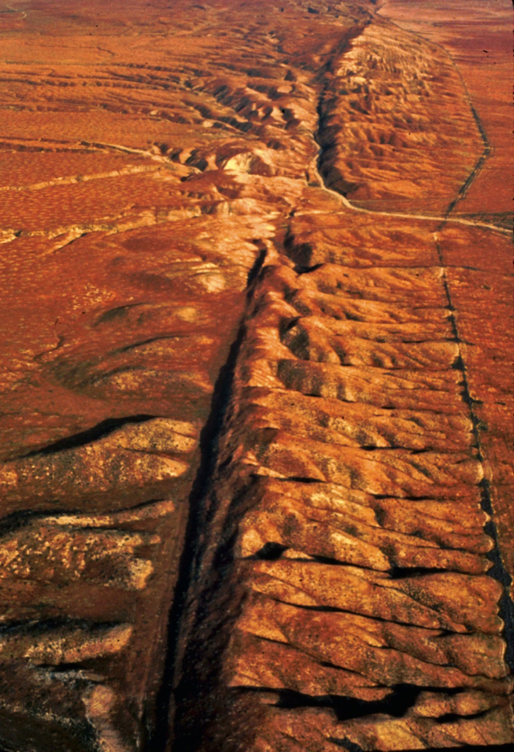
| Description: Huge pieces of Earth’s outer layer of rock slowly drift apart and collide. As these plates move, they convey continents around the globe. The current configuration of the plates is shown in Appendix VII. 1 At oceanic ridges, plumes of molten rock welling up from Earth’s interior drive the movement of tectonic plates. New crust spreads outward as it forms on the surface, forcing adjacent tectonic plates away from the ridge and into trenches elsewhere. 2 At trenches, the advancing edge of one plate plows under an adjacent plate and buckles it. 3 Faults are ruptures in Earth’s crust where plates meet. The diagram shows a rift fault, in which plates move apart. The aerial photo (left) shows about 4.2 kilometers (2.6 miles) of the San Andreas Fault, which extends 1,300 km (800 miles) through California. The San Andreas fault is a boundary between two tectonic plates slipping against one another in opposite directions. 4 Plumes of molten rock rupture a tectonic plate at what are called “hot spots.” The Hawaiian Islands have been forming from molten rock that continues to erupt from a hot spot under the Pacific (tectonic) Plate. Picture Stats: Views: 45 Filesize: 456.87kB Height: 1500 Width: 1026 Source: https://biology-forums.com/index.php?action=gallery;sa=view;id=48577 |