|
|
|

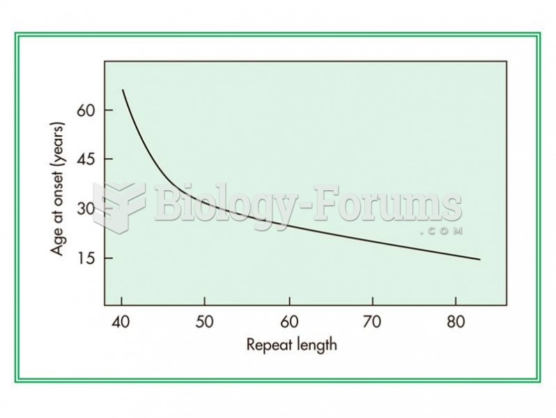 Relationship between the number of CAG repeats in a gene and the age of onset of Huntington disease.
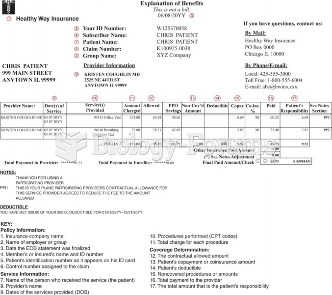 Example of an Explanation of Benefits statement.
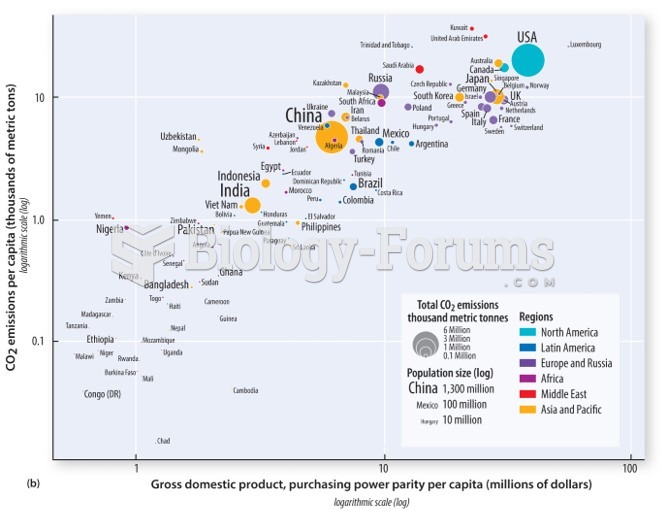 A close relationship between greenhouse gas emissions and a country’s gross domestic product
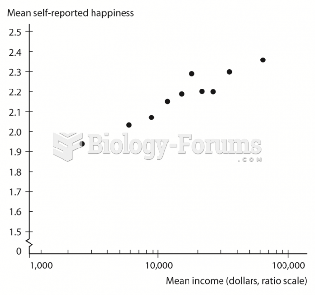 Relationship between Income and Happiness in the United States
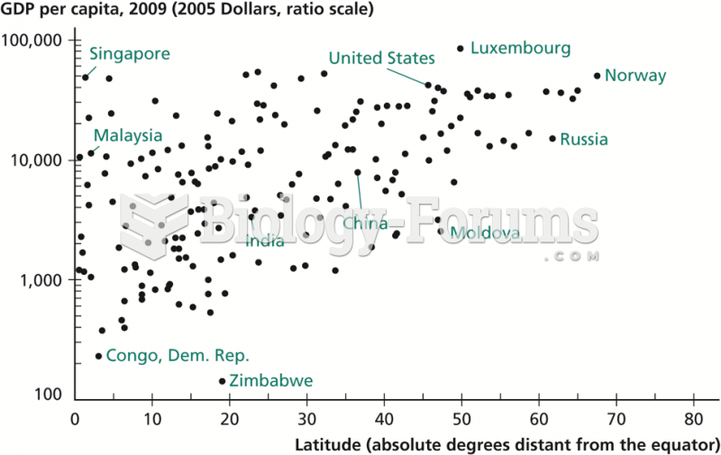 Relationship between Latitude and Income per Capita
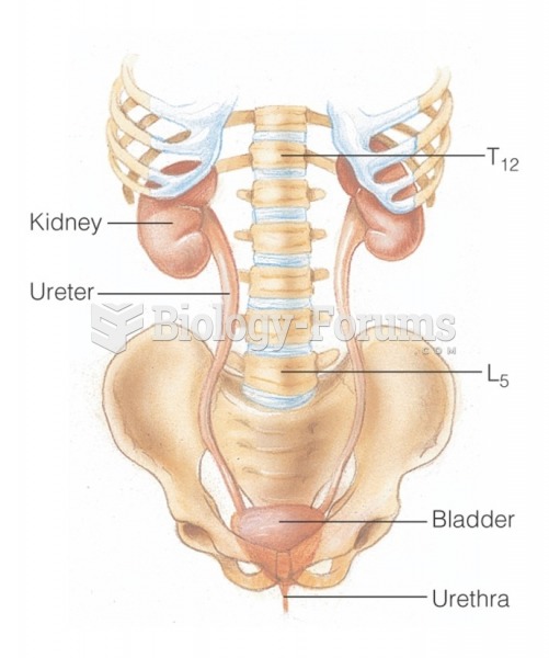 The urinary system: Relationship of the kidneys to the vertebrae