 |
| Previous Image | Next Image |
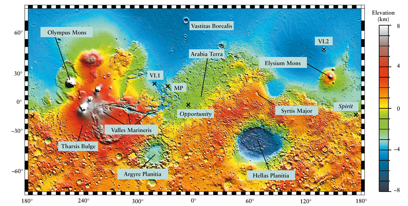
| Description: The color coding on this map of Mars shows elevations above (positive numbers) or below (negative numbers) the planet’s average radius. To produce this map, an instrument on board Mars Global Surveyor fired pulses of laser light at the planet’s surface, then measured how long it took each reflected pulse to return to the spacecraft. The Viking 1 Lander (VL1), Viking 2 Lander (VL2), Mars Pathfinder (MP), Opportunity, and Spirit landing sites are each marked with an X Picture Stats: Views: 707 Filesize: 608.35kB Height: 683 Width: 1350 Source: https://biology-forums.com/index.php?action=gallery;sa=view;id=16068 |