 |
| Previous Image | Next Image |
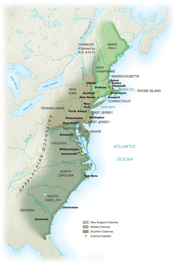
| Description: The boundaries of English colonies were partially determined by geographical factors—usually the Atlantic Ocean to the east and the Appalachian mountains in the west, beyond which few colonists settled prior to 1750. Most colonial charters set the north/south borders of a colony according to a particular line of latitude—that is, the distance a place is located in relation to the equator.
Picture Stats: Views: 672 Filesize: 527.17kB Height: 884 Width: 585 Source: https://biology-forums.com/index.php?action=gallery;sa=view;id=22223 |
