 |
| Previous Image | Next Image |
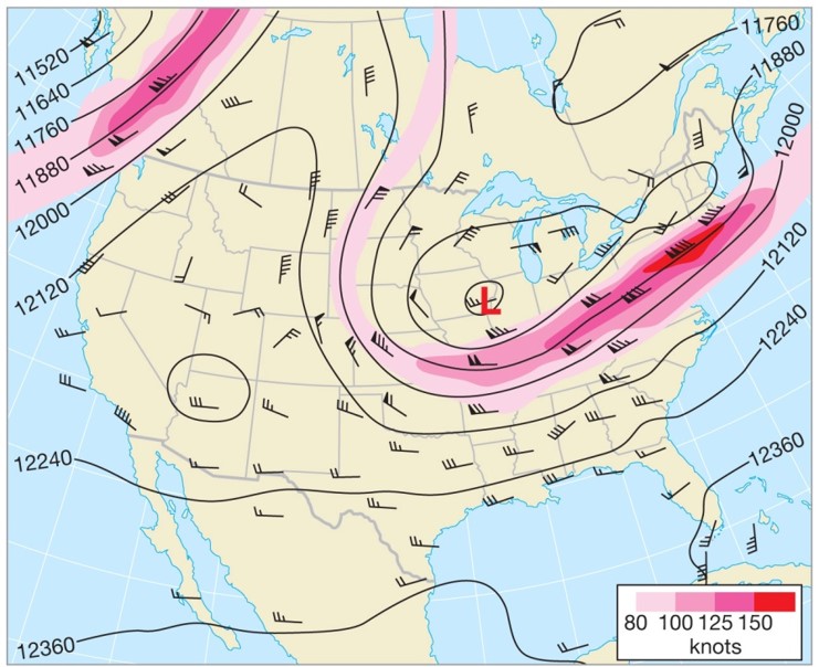
| Description: 300- and 200-mb maps: - These maps represent zones near the top of the troposphere. - The jet stream is best observed at these levels. Picture Stats: Views: 260 Filesize: 116.95kB Height: 604 Width: 741 Source: https://biology-forums.com/index.php?action=gallery;sa=view;id=31239 |