 |
| Previous Image | Next Image |
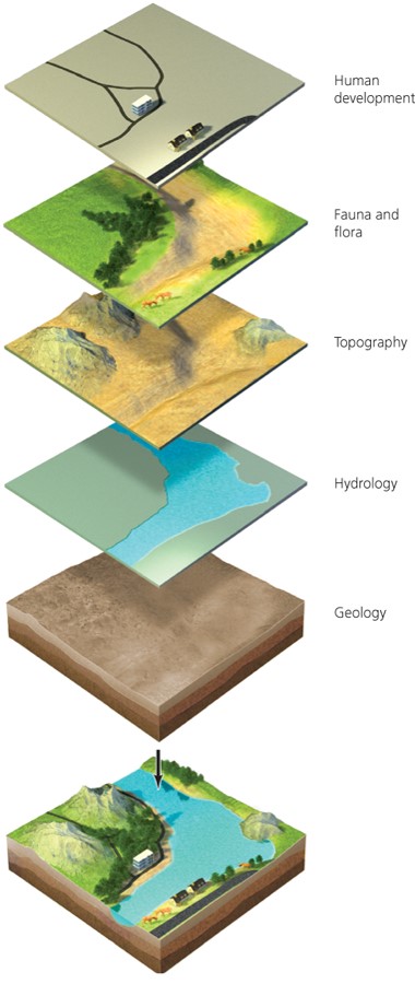
| Description: Remote sensing technologies Allow scientists to create a complete picture of the landscape Geographic information system (GIS) = computer software used in landscape ecology research Can analyze how elements within the landscape are arranged Helps make planning and land-use decisions Picture Stats: Views: 381 Filesize: 61.62kB Height: 900 Width: 380 Source: https://biology-forums.com/index.php?action=gallery;sa=view;id=35632 |