 |
| Previous Image | Next Image |
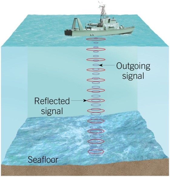
| Description: Echo sounder (also referred to as sonar) Invented in the 1920s Primary instrument for measuring depth Reflects sound from ocean floor Bathymetry – measurement of ocean depths and the charting of the shape or topography of the ocean floor Picture Stats: Views: 340 Filesize: 61.72kB Height: 586 Width: 561 Source: https://biology-forums.com/index.php?action=gallery;sa=view;id=39451 |