Answer to Question 1
ANSWER: Persistence: a prediction that future weather will be the same as present weather. If it is snowing today, a persistence forecast would call for snow through tomorrow. Steady-state (trend) method: The principle involved here is that surface weather systems tend to move in the same direction and at approximately the same speed as they have been moving, providing no evidence exists to indicate otherwise. Suppose, for example, that a cold front is moving eastward at an average speed of 30 km per hour and it is 90 km west of your home. Using the steady-state method, we might extrapolate and predict that the front should pass through your area in three hours. Analogue method: this method relies on the fact that existing features on a weather chart (or a series of charts) may strongly resemble features that produced certain weather conditions sometime in the past. A forecaster might look at a prog and say Ive seen this weather situation before, and this happened. Prior weather events can then be utilized as a guide to the future. Statistical methods: known as Model Output Statistics, or MOS, these predictions, in effect, are statistically weighted analogue forecast corrections incorporated into the computer model output. For example, a forecast of tomorrows maximum temperature might be derived from a statistical equation that uses a numerical models forecast of relative humidity, cloud cover, wind direction, and air temperature.
Answer to Question 2
ANSWER: Doppler radars provide round-the-clock information on the evolution of rain, snow, sleet, and hail. Because Doppler radar can track winds as well as precipitation, it is also a valuable tool in providing warnings of destructive windstorms and tornadoes. Some of the most advanced computer forecast models are now being designed to incorporate information from radars, which could help improve forecasts significantly.

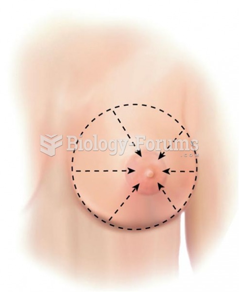 Breast Palpation Methods, Wedge
 Radiological Modalities (Methods) Cont.
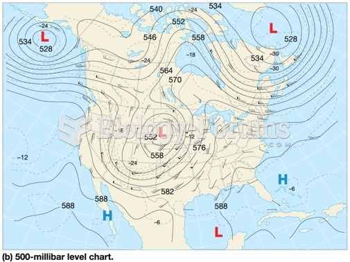 Weather maps: Pictures of the atmosphere
 How to describe transformations of a sinusoidal function (y=a*sinb(x−c)+d)
 Popular Methods of Conducting Social Science Research
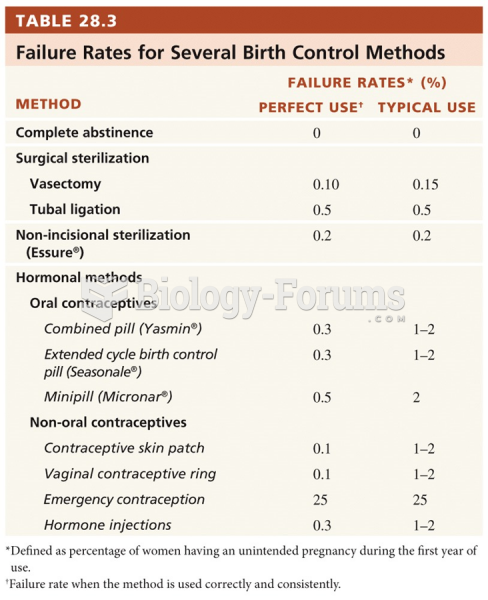 Birth Control Methods and Abortion