Answer to Question 1
ANSWER: When upper-level divergence is stronger than surface convergence (more air is taken out at the to than is brought in at the bottom), surface pressures drop, and the low intensifies (deepens). By the same token, when upper-level divergence is less than surface convergence (more air flows in at the bottom than is removed at the top), surface pressures rise, and the system weakens.
When upper-level convergence of air exceeds low-level divergence (inflow at top is greater than outflow near the surface), surface pressures rise, and the anticyclone builds. On the other hand, when upper-level convergence of air is less than low-level divergence, the anticyclone weakens as surface pressures fall.
Answer to Question 2
ANSWER: If the upper-level low is directly above the surface low, only at the surface (because of friction) do the winds blow inward toward the lows center. As these winds converge (flow together), the air piles up. This piling up of air, called convergence, causes air density to increase directly above the surface low. This increase in mass causes surface pressures to rise; gradually, the low fills and the surface low dissipates. The same reasoning can be applied to surface anticyclones. Winds blow outward, away from the center of a surface high. If a closed high or ridge lies directly over the surface anticyclone, divergence (the spreading out of air) at the surface will remove air from the column directly above the high. The decrease in mass causes the surface pressure to fall and the surface high-pressure area to weaken. Consequently, it appears that, if upper-level pressure systems were always located directly above those at the surface, cyclones and anticyclones would die out soon after they form (if they could form at all).

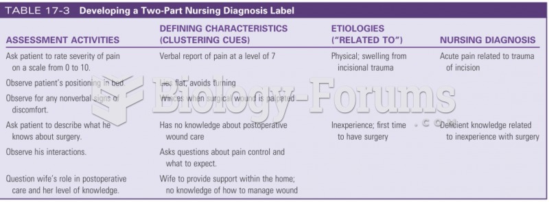 Developing a two part nursing diagnostic label
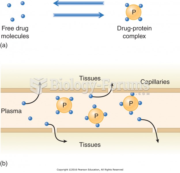 Plasma protein binding and drug availability: (a) The drug exists in a free state or is bound to ...
 Influence of Latitude
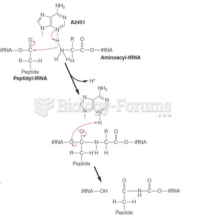 A mechanism for peptidyltransferase involving A2451 (E. coli) as a general base
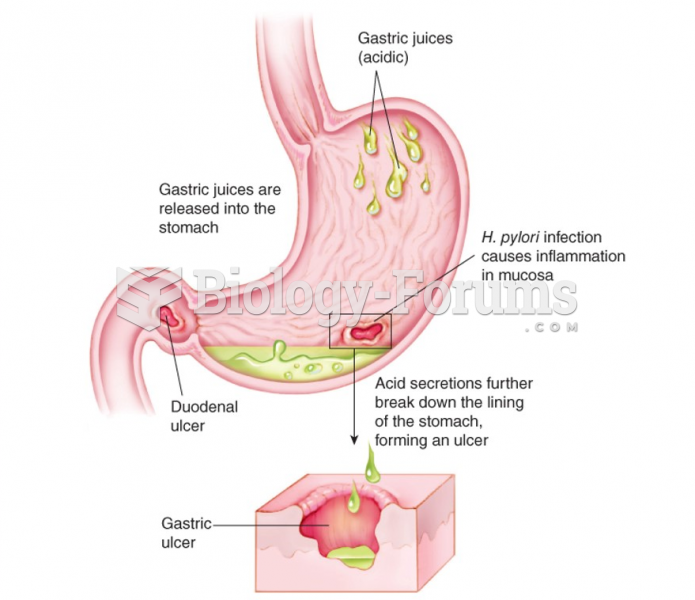 Mechanism of peptic ulcer formation
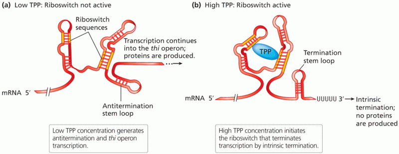 Transcriptional regulation by a riboswitch mechanism