Answer to Question 1
ANSWER: Drylines are not warm fronts or cold fronts, but represent a narrow boundary where there is a steep horizontal change in moisture. Thus, drylines separate moist air from dry air. Because dew-point temperatures may drop along this boundary by as much as 9 degrees Celsius (16 degrees Fahrenheit) per km, drylines have been referred to as dew-point fronts.
On one side of the dryline, warm, dry continental tropical air may exist, whilst on the other side, the weather is hot and dry with gusty winds. Sometimes drylines are associated with mid-latitude cyclones, and sometimes they are not. Cumulus clouds and thunderstorms often form along or to the east of the dryline. This cloud development is caused in part by daytime convection and differences in terrain.
Answer to Question 2
ANSWER: When a cold front catches up to and overtakes a warm front, the frontal boundary created between the two air masses is called anoccluded front, or, simply, an occlusion. Locating and defining occluded fronts at the surface is often difficult since the associated weather patterns are similar to those observed in approaching warm fronts.

 Label the cutbank and point bar on this image.
 Nancy Rubins, Pleasure Point.
 Satellites in Weather Forecasting
 Types of Respiratory Protection Devices
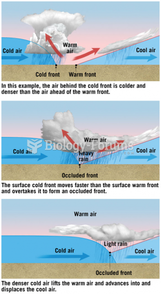 Formation of an Occluded Front
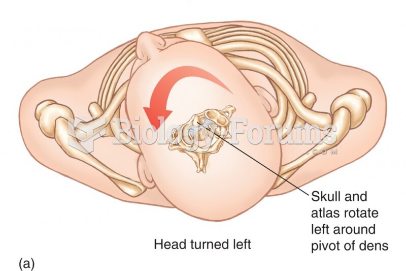 Relationship Between the Atlas and the Axis. The Dens of the Axis Provides a Pivotal Point Around Wh