Answer to Question 1
ANSWER: Some of the weather changes would be sharp temperature changes over a relatively short distance, changes in the airs moisture content (as shown by marked changes in the dew point), shifts in wind direction, pressure and pressure changes, clouds, and precipitation patterns.
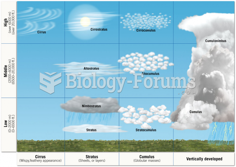
More specifically, the lowest pressure usually occurs just as the front passes a station. As you move toward the front, the pressure drops, and, as you move away from it, the pressure rises. The precipitation pattern along the cold front might be that light-to-moderate rain occurs over a wide area along the front, while heavier precipitation is found in a narrow band along the front itself. Strong thunderstorms can be found only in certain areas along this front. A commonly observed cloud and precipitation patterns might be that as the moist, conditionally unstable air rises, it condenses into a series of cumuliform clouds. Strong, upper-level westerly winds blow the delicate ice crystals (which form near the top of the cumulonimbus) into cirrostratus and cirrus. These clouds usually appear far in advance of the approaching front. At the front itself, a relatively narrow band of thunderstorms produces heavy showers with gusty winds. Behind the front, the air cools quickly. The winds shift, pressure rises, and precipitation ends. As the air dries out, the skies clear, except for a few lingering cumulus clouds.
Answer to Question 2
ANSWER: When the cold, dry air mass (cP) moves over a relatively warm body of water, such as the Great Lakes, heavy snow showerscalled lake-effect snowsoften form on downwind shores.
In the United States when maritime polar (mP) air moves inland, it loses much of its moisture as it crosses a series of mountain ranges. Beyond these mountains, it travels over a cold, elevated plateau that chills the surface air and slowly transforms the lower level into dry, stable continental polar air. East of the Rockies this type of air mass is referred to as Pacific air. Here, it often brings fair weather and temperatures that are cool but not nearly as cold as the continental polar and arctic air that invades this region from northern Canada.


