Answer to Question 1
ANSWER: Student answers may vary slightly but the figure needs to demonstrate that geostationary satellites (or geosynchronous satellites) orbit the equator at the same rate Earth spins and, hence, remain above a fixed spot on Earth's surface, at an altitude of nearly 36,000 km (22,300 mi). This positioning allows continuous monitoring of a specific region. Geostationary satellites are also important because they use a real time data system meaning that satellites transmit images to the receiving system on the ground as soon as the image is taken. Successive cloud images from these satellites can be put into a time-lapse movie sequence to show the cloud movement, dissipation, or development associated with weather fronts and storms. This information is a great help in forecasting the progress of large weather systems. Wind directions and speeds at various levels may also be approximated by monitoring cloud movement with the geostationary satellite.
Polar-orbiting satellites closely parallel Earth's meridian lines. These satellites pass over the north and south polar regions on each revolution. As Earth rotates to the east beneath the satellite, each pass monitors an area to the west of the previous pass. Eventually, the satellite covers the entire Earth. Polar-orbiting satellites have the advantage of scanning clouds directly beneath them as they move. They can gather sharp images from polar regions where images from a geostationary satellite are distorted because of the low angle at which the satellite sees this region. Polar orbiters circle Earth at a much lower altitude (about 850 km) than geostationary satellites, which allows them to provide more detailed images of clouds and storms.
Answer to Question 2
ANSWER: Clouds form either by: (1) coolingair is cooled below its saturation point (dew point) or (2) evaporation and mixingwater vapor is added to the air by evaporation and moist air mixes with relatively dry air. In general, air temperature within the troposphere decreases with altitude, hence it is expected to have clouds forming as air rises. However, for cloud formation to occur condensation nuclei must be present in the atmosphere. The condensation nuclei most favorable for producing clouds (called cloud condensation nuclei) have radii of 0.1 m or more. Usually, between 100 and 1000 nuclei of this size exist in a cubic centimeter of air. These particles enter the atmosphere in a variety of ways: dust, volcanoes, factory smoke, forest fires, salt from ocean spray, and even sulfate particles emitted by phytoplankton in the oceans. In fact, studies show that sulfates provide the major source of cloud condensation nuclei in the marine atmosphere. Because most particles are released into the atmosphere near the ground, the largest concentrations of nuclei are observed in the lower atmosphere near Earth's surface. Condensation nuclei are extremely light (many have a mass less than one-trillionth of a gram), so can remain suspended in the air for many days.

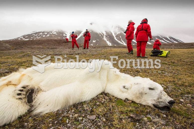 Dead polar bears
 Demonstrate the Application of Triangular, Figure-Eight, and Tubular Bandages
 What title would chemists give to an orbital characterized by n=8 and 1=4?
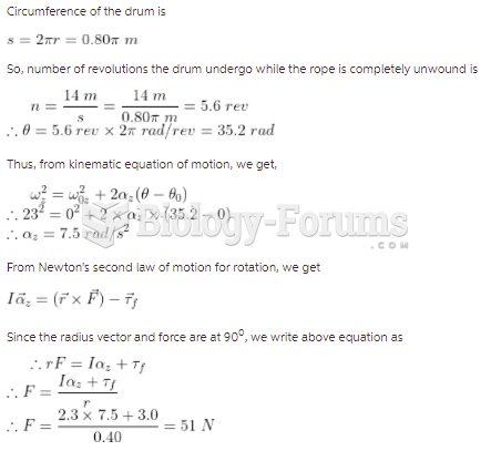 The drum shown in the figure has a radius of 0.40 m and a moment of inertia of 2.3 kg m2about ...
 Frequency distribution of phenotypes from the possible offspring in Figure 5.7. Height of the offspr