This topic contains a solution. Click here to go to the answer
|
|
|

 False killer whales
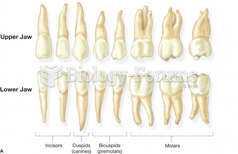 (A) The name and shape of the adult teeth. These teeth represent those found in the right side of th
 Color enhanced X ray of large malignant tumor in the right lung.
 With the research technique called brainbow, each neuron is labeled with a different color, ...
 Remove cold source, and check the knee for changes. Notice skin color and changes in swelling around ...
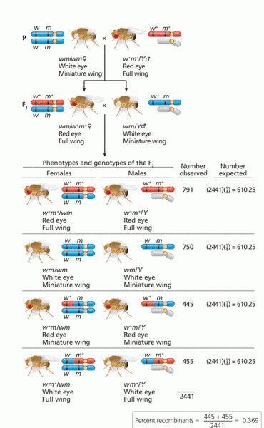 Morgan’s analysis of genetic linkage of X-linked genes for eye color