This topic contains a solution. Click here to go to the answer
|
|
|

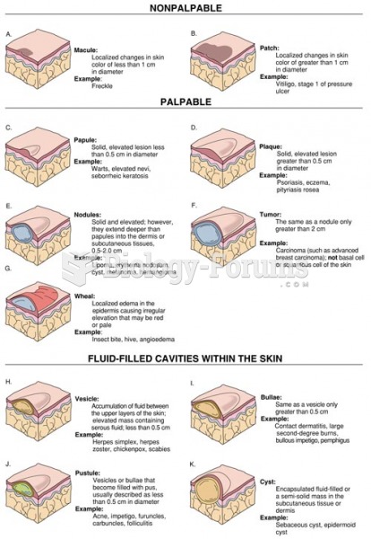 Morphology of Primary Lesions
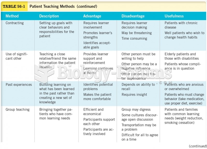 Patient Teaching Methods Cont.
 Patient Teaching Methods Cont.
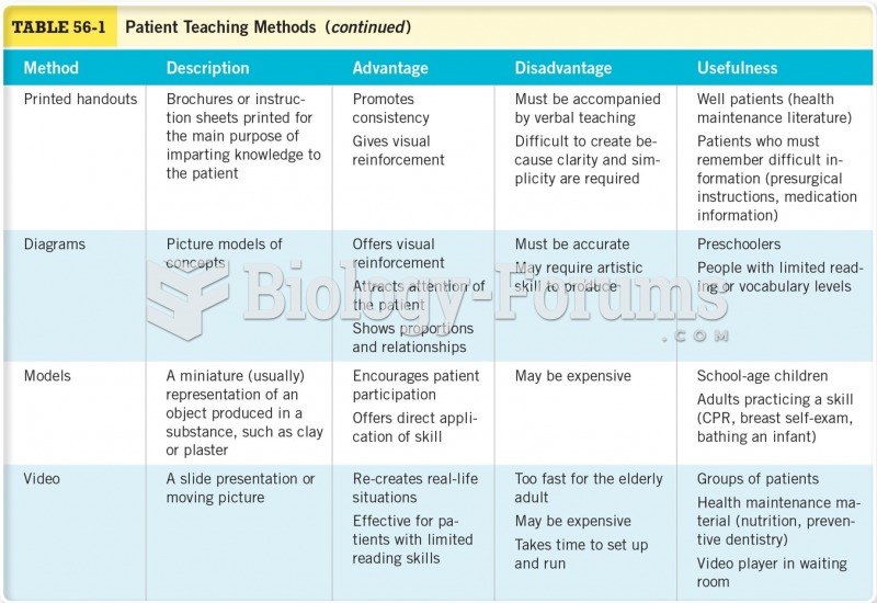
 Upper-Level Maps
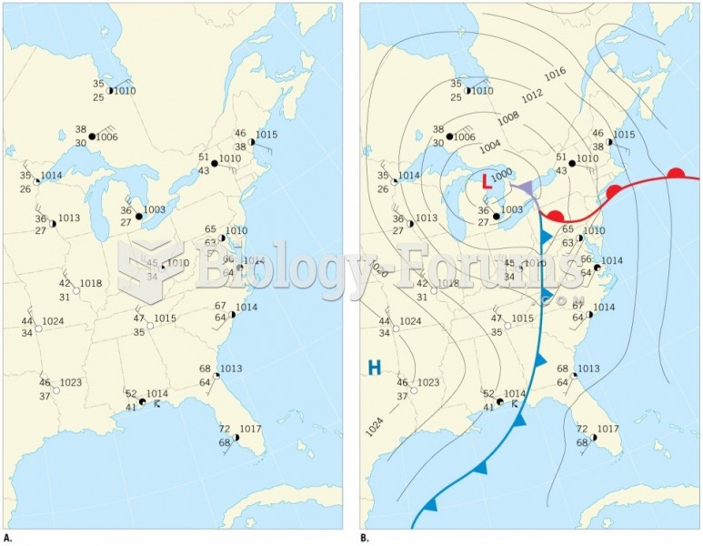 Weather Maps
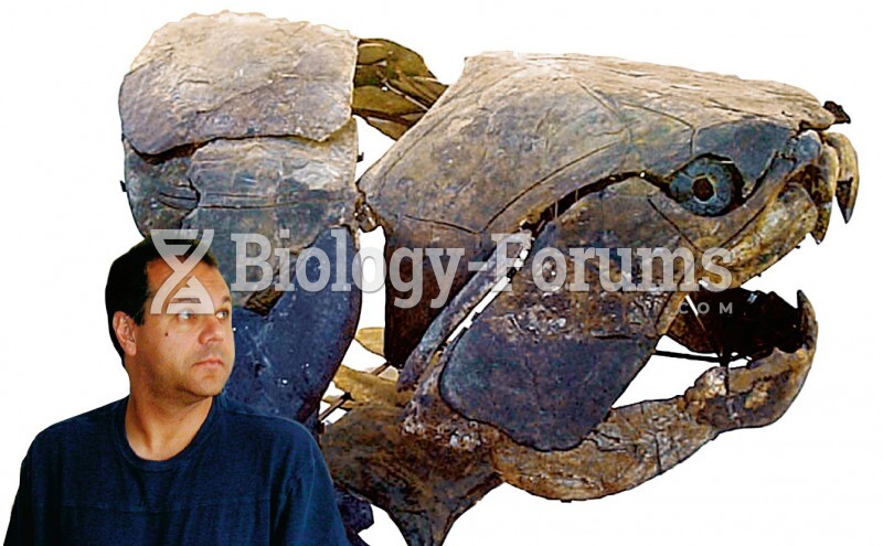 Cast of a Fossil Dunkleosteus, with a human to illustrate scale