This topic contains a solution. Click here to go to the answer
|
|
|

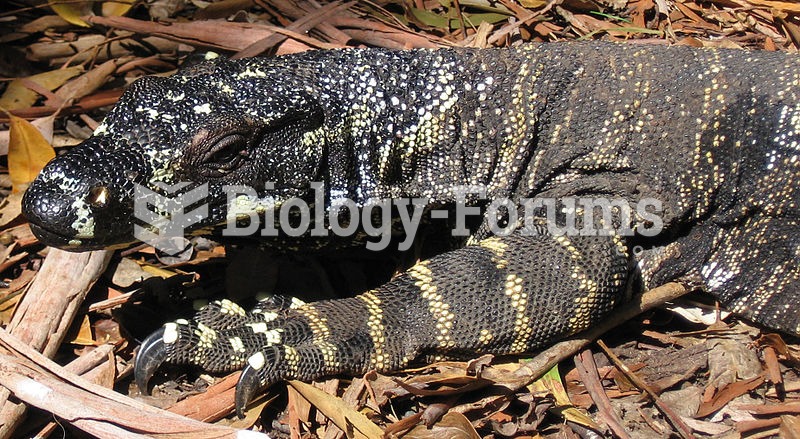 Lace Monitor (Varanus varius)
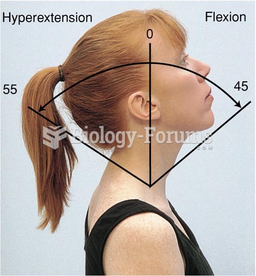 Range of Motion of the Cervical Spine, Flexion, Hyperextension
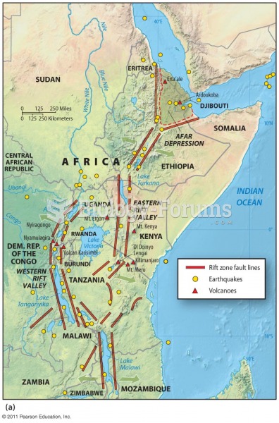 Earthquakes at Divergent Plate Boundaries
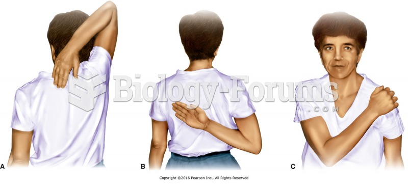 Active range of motion (AROM) tests for the shoulder. A, Apley Scratch Test. B and C, Internal ...
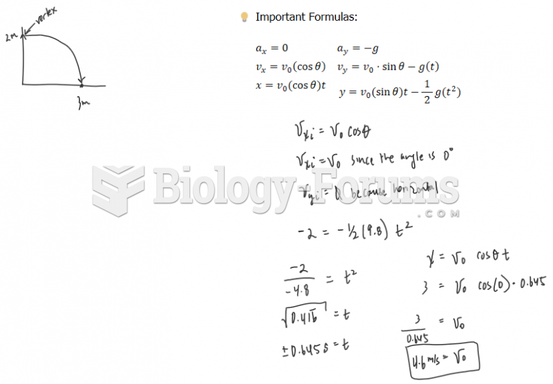 Physics - Motion (Please help me solve these problems, I really need help)
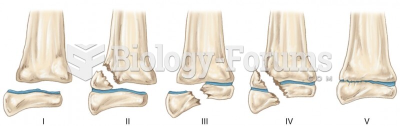 The Salter-Harris System of Classifying Growth-Plate Injuries. The Likelihood of a Permanent Growth-