This topic contains a solution. Click here to go to the answer
|
|
|

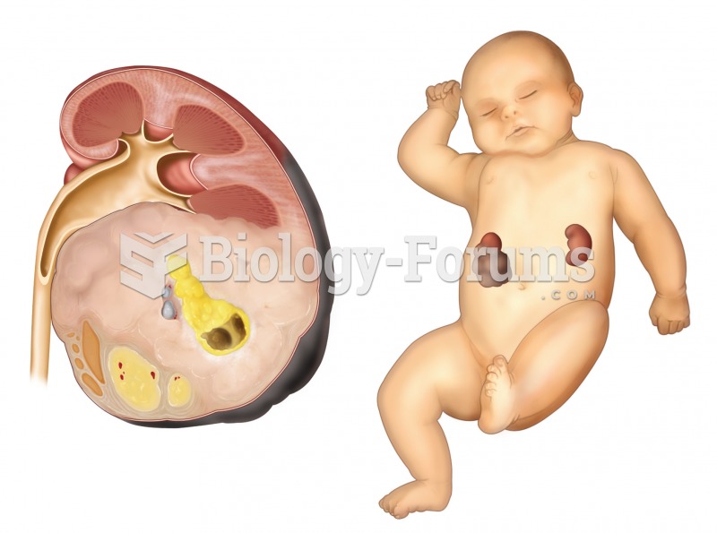 Nephroblastoma. A sectioned kidney reveals the presence of a very large tumor, which arose from feta
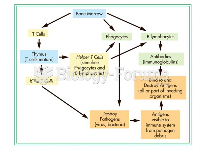 The immune system has several different components that work in concert.
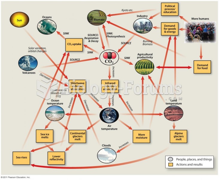 The Global Climate System Is Very Complex
 People are living longer today than in previous decades
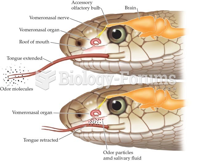 vomerolfactory system
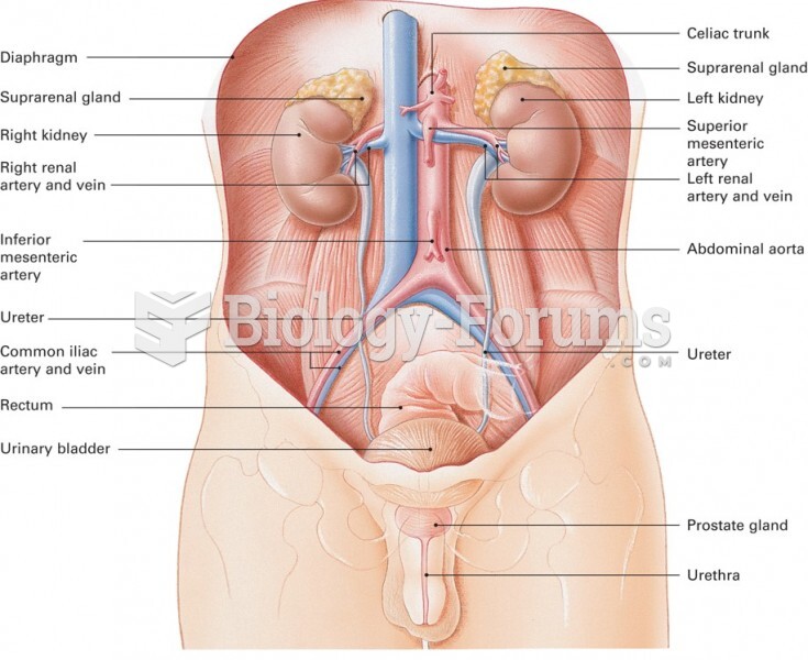 Major Elements of the Genitourinary System