Answer to Question 1
ANSWER: This happens if the top of the original cloud deck cools while the bottom warms. Because clouds are such good absorbers and emitters of infrared radiation, the top of the cloud will often cool as it radiates infrared energy to space more rapidly than it absorbs solar energy. Meanwhile, the bottom of the cloud will warm as it absorbs infrared energy from below more quickly than it radiates this energy away. This process makes the cloud layer conditionally unstable to the point that small convection cells begin within the cloud itself. The up and down motions in a layered cloud produce globular elements that give the cloud a lumpy appearance. The cloud forms in the rising part of a cell, and clear spaces appear where descending currents occur.
Answer to Question 2
ANSWER: When surface air gets heated up a hot bubble of aira thermalbreaks away from the warm surface and rises, expanding and cooling as it ascends. As the thermal rises, it mixes with the cooler, drier air around it and gradually loses its identity. Its upward movement now slows. Before it is completely diluted, subsequent rising thermals often penetrate it and help the air rise a little higher. If the rising air cools to its saturation point, the moisture will condense, and the thermal becomes visible to us as a cumulus cloud. On the outside of cumulus clouds, the air motions are downward, which is caused in part by evaporation around the outer edge of the cloud, which cools the air, making it heavy. Another reason for the downward motion is the completion of the convection current started by the thermal. Cool air slowly descends to replace the rising warm air. Therefore, we have rising air in the cloud and sinking air around it.

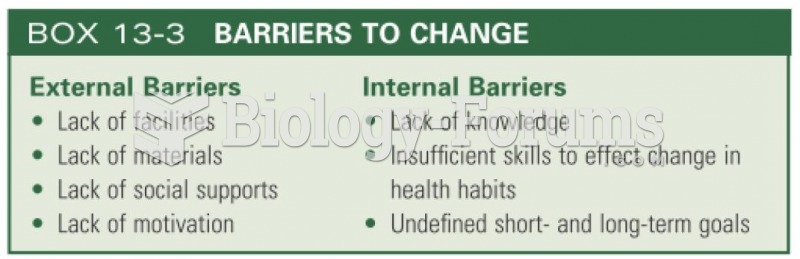 Barriers to change
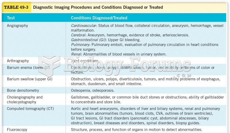 Diagnostic Imaging Procedures and Conditions Diagnosed or Treated
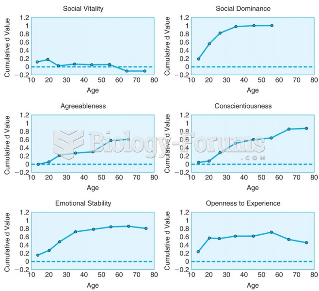 Cumulative change for six personality-trait domains across the life course show distinct patterns.
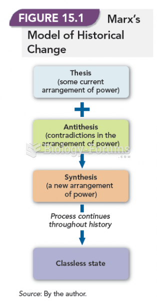 Marx's Model of Historical Change
 A Layer Based on Electrical Properties: The Ionosphere
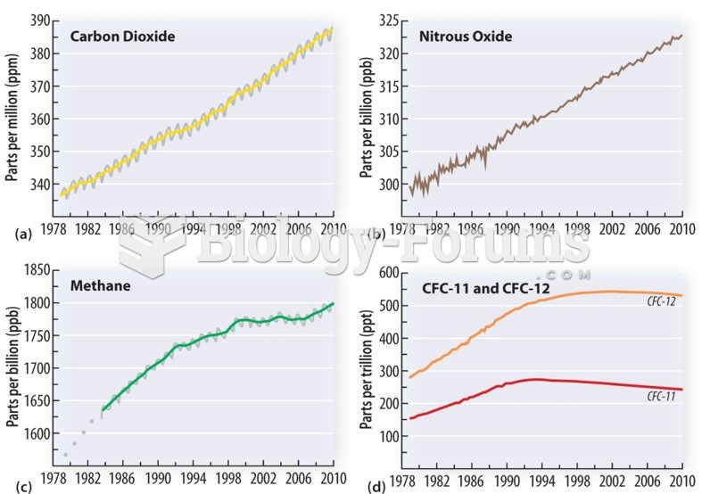 Climate Change: Greenhouse gases Timescale