|
|
|

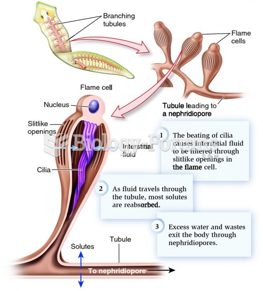 The protonephridial filtration system of flatworms.
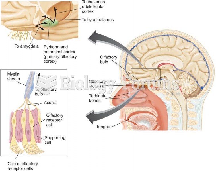 The Olfactory System
 Anna Freud’s Instinctual Theory
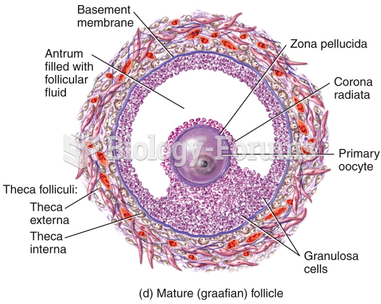 Female Reproductive System - Mature (graafian) follicle "الجهاز التناسلي ...
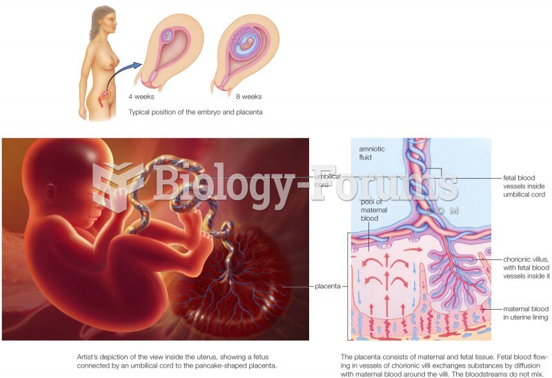 Life support system of a developing human
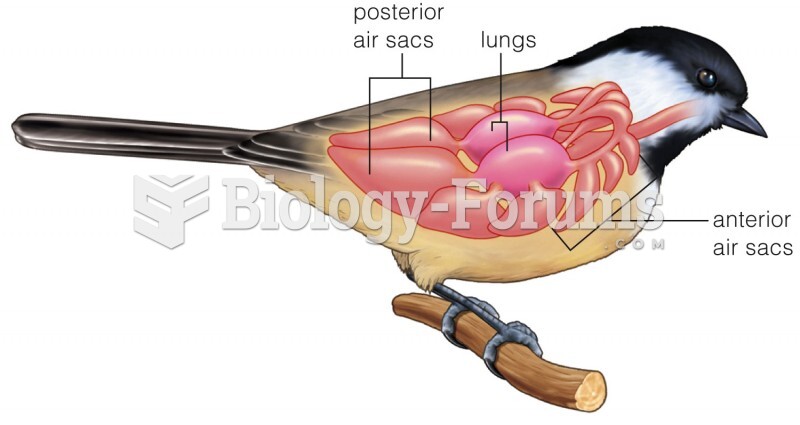 Respiratory system of a bird.