This topic contains a solution. Click here to go to the answer
|
|
|

 The small-scale distribution of different tree species in a Douglas-fir forest is determined by both
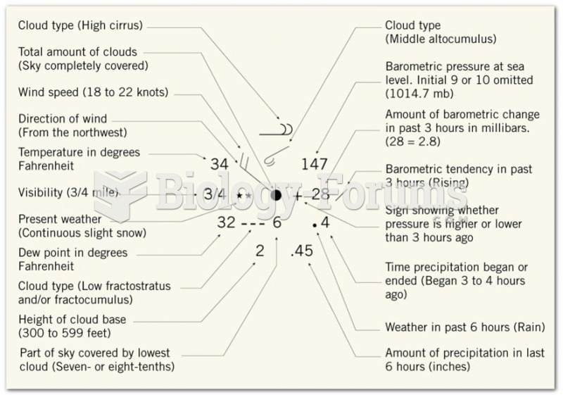 Weather Maps
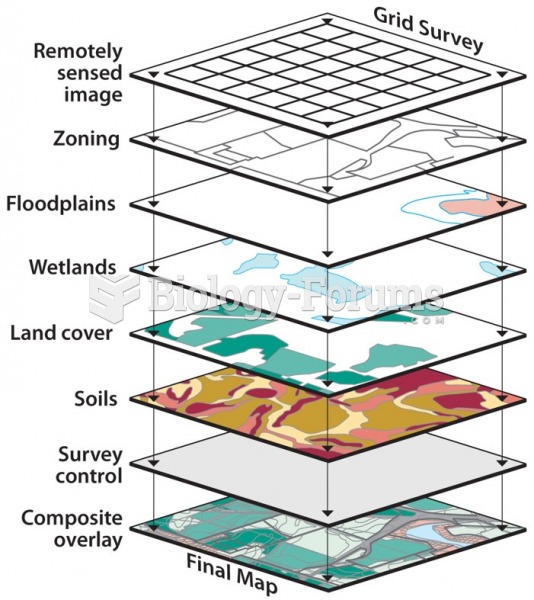 The Geographer’s Toolbox: Location, Maps, Remote Sensing, and GIS
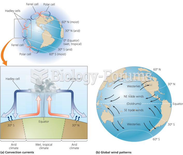 Large-scale circulation systems produce global climate patterns
 A very light ideal spring stretches by when it is used to hang a 135-N object. What is the ...
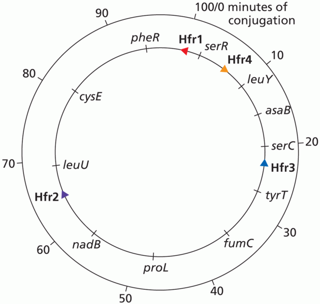 Consolidation of Hfr Maps