Answer to Question 1
Answer: D
Answer to Question 2
Answer: Mesoscale convective systems: MCSs can bring intense weather conditions to areas covering several counties. They often have life spans of up to 12 hours, but in some cases they can exist for as long as several days. They are fairly common in North America, and in some parts of the central United States and Canada they account for as much as 60 percent of the annual rainfall. Because the surrounding circulation supports an MCS, they lead to much stronger winds and heavier precipitation than is normally found in an air mass thunderstorm. Supercells: Supercells are intensely powerful storms that contain a single updraft zone. Although supercells often appear in isolation, they can also occur as a part of an MCS. Squall line thunderstorms: Squall line thunderstorms consist of a large number of individual violent storm cells arranged in a linear band, typically about 500 km (300 mi) in length. Although squall lines may be as much as 100 km (60 mi) in width, the embedded band of intense showers is much narrower, usually about 5 km (3 mi), and located near the leading edge of the advancing band of cloud cover and precipitation. A wide area of continuous precipitation normally exists in the central and western portions of the squall line, immediately behind the band of heavy showers.
Squall lines usually form in the warm sector of a midlatitude cyclone immediately ahead of the cold front but then advance more rapidly than the front itself. They may eventually reside about 300 to 500 km (180 to 300 mi) ahead of the front. Squall lines are most common over the southern United States during spring and summer. The average squall line has a life span on the order of 10 hours, though some have lasted up to four days. Supercell storms: Supercell storms are remarkably complex, with the updraft and downdraft bending and wrapping around each other due to strong wind shear.

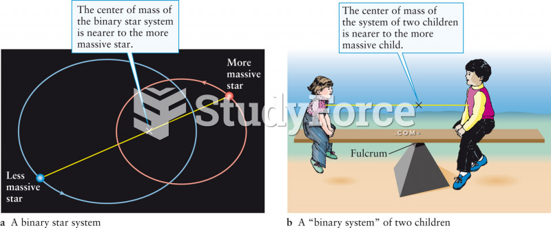 Center of Mass of a Binary Star System
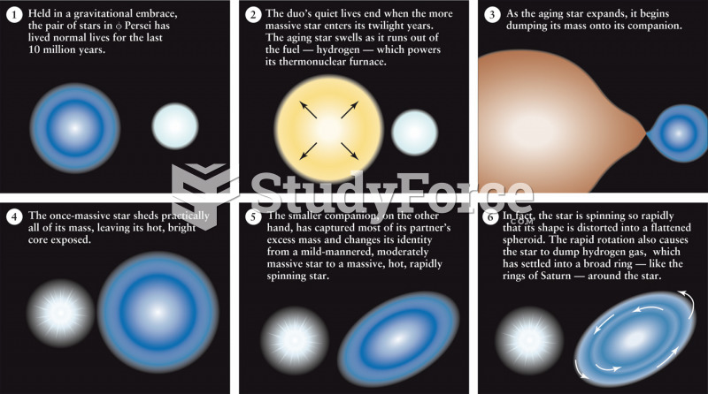 Mass Exchange Between Close Binary Stars
 Mass Loss by a Supermassive Star
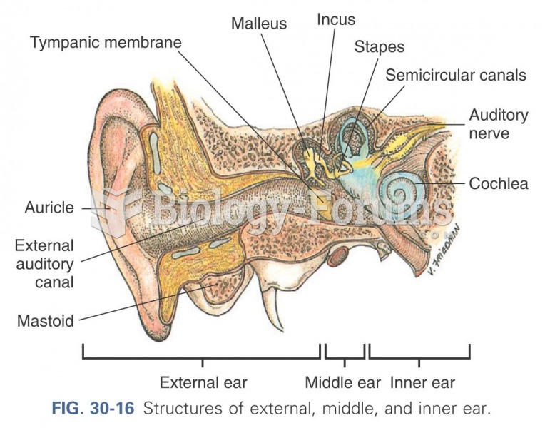 Structures of external, middle, and inner ear
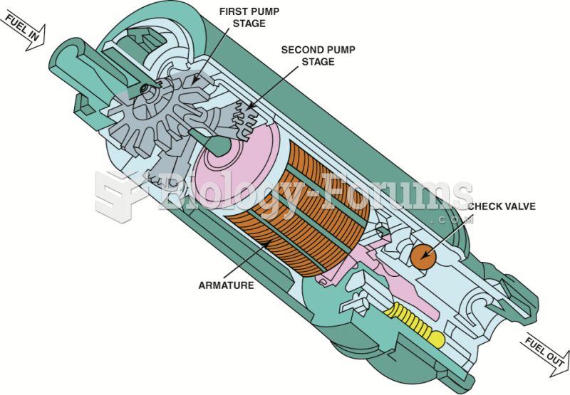 A cutaway view of a typical two-stage turbine electric fuel pump.
 Find the speed after 40.0 min if the initial speed is 3250 rev/min