|
|
|

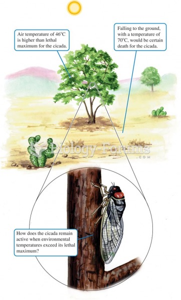 An ecological puzzle: the cicada, Diceroprocta apache, is active when air temperatures would appear
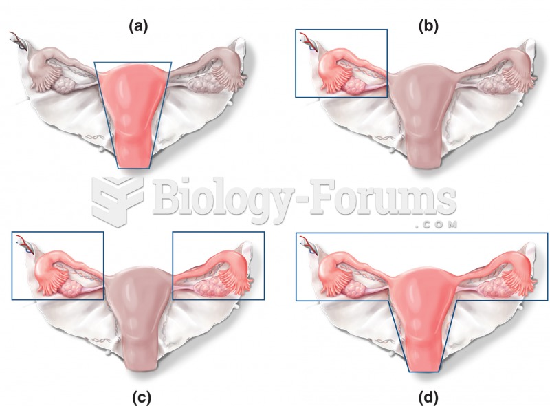 Alternative forms of surgeries involving the uterus, ovaries, and fallopian tubes. The solid lines i
 Mitosis + Check Points 1 of 5
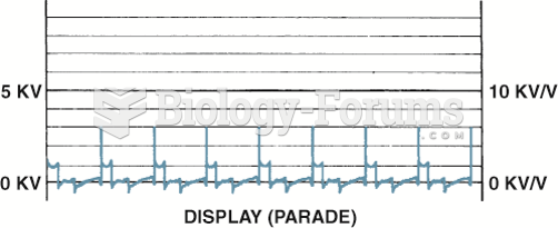 Display is the only position to view the firing lines of all cylinders. Cylinder 1 is displayed on ...
 Planet Z-34 has a mass equal to 1/3 that of Earth, a radius equal to 1/3 that of Earth, and an ...
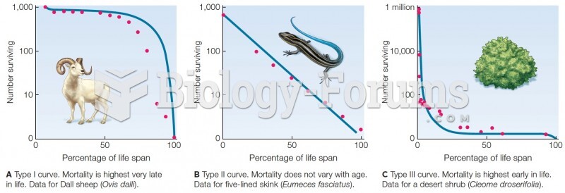 Survivorship curves. Blue lines are theoretical curves. Red dots are data from field studies.