This topic contains a solution. Click here to go to the answer
|
|
|

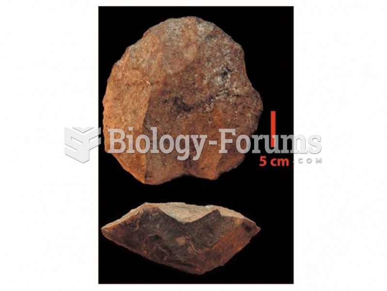 A levallois core from Kapedo Tuffs, Kenya dates about 130,000 years ago.
 How long does it take you to see the circles?
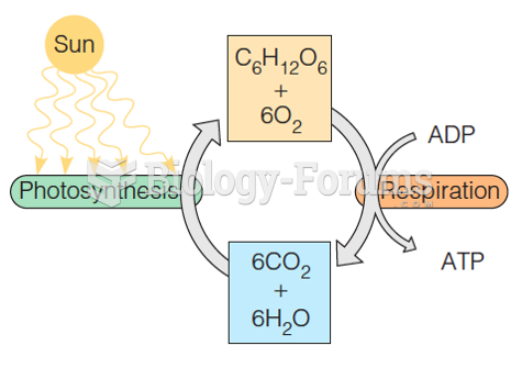 The energy cycle of life
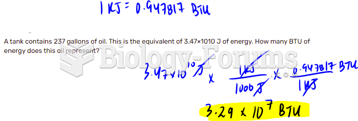 Energy and Energy Units
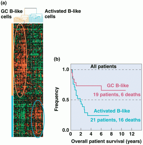 Gene-expression analysis generated from expression DNA microarrays