|
|
|

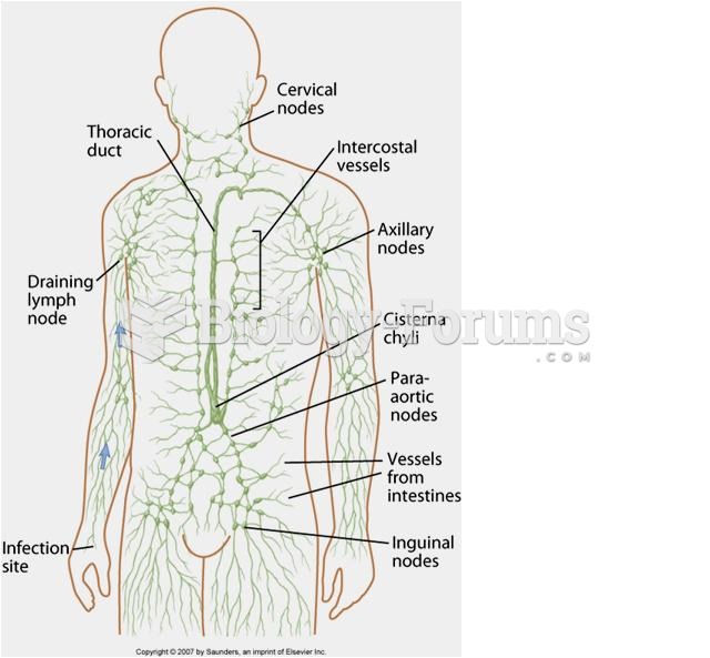 The lymphatic system
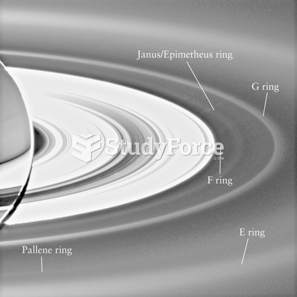 Saturn’s Ring System
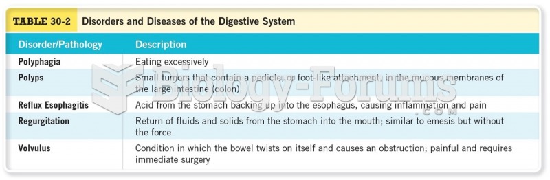 Disorders and Diseases of the Digestive System Cont
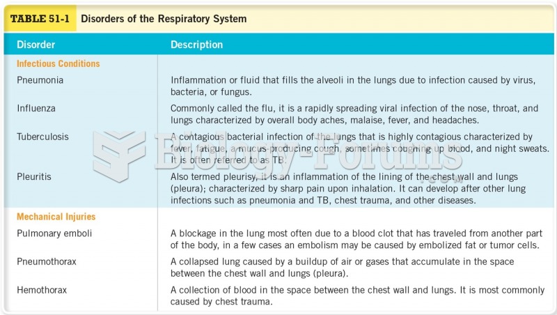 Disorders of the Respiratory System Cont
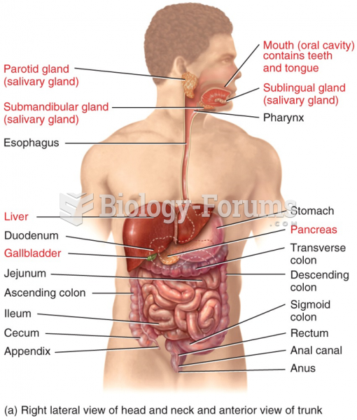 Organs of the Digestive System
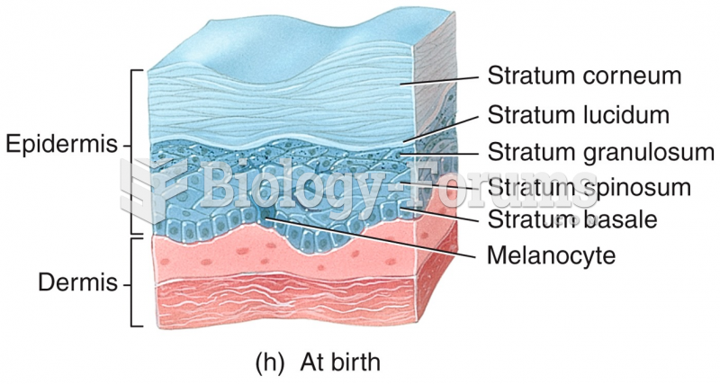 Development of the Integumentary System