This topic contains a solution. Click here to go to the answer
|
|
|

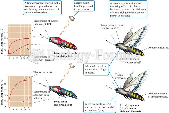 The circulatory system plays a central role in thermoregulation by the moth, Manduca sexta
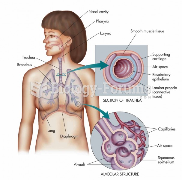 The respiratory system: nasal cavity, pharynx, larynx, trachea, bronchus, and lung with expanded vie
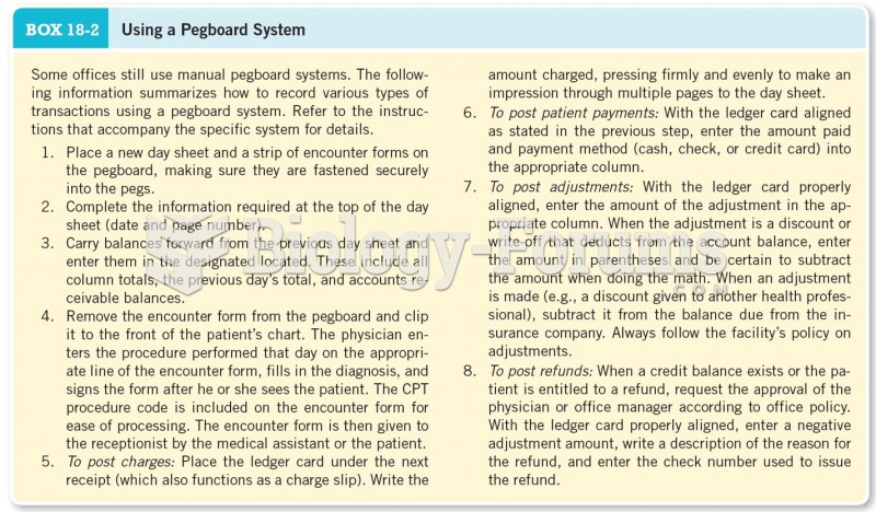 Using a Pegboard System
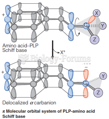 Pi molecular orbital system of PLP-amino acid Schiff base
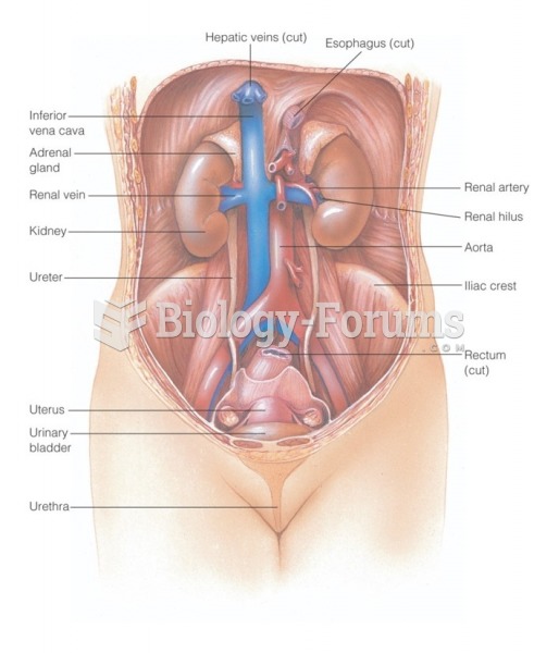 The urinary system: Anterior view of the urinary organs of a female
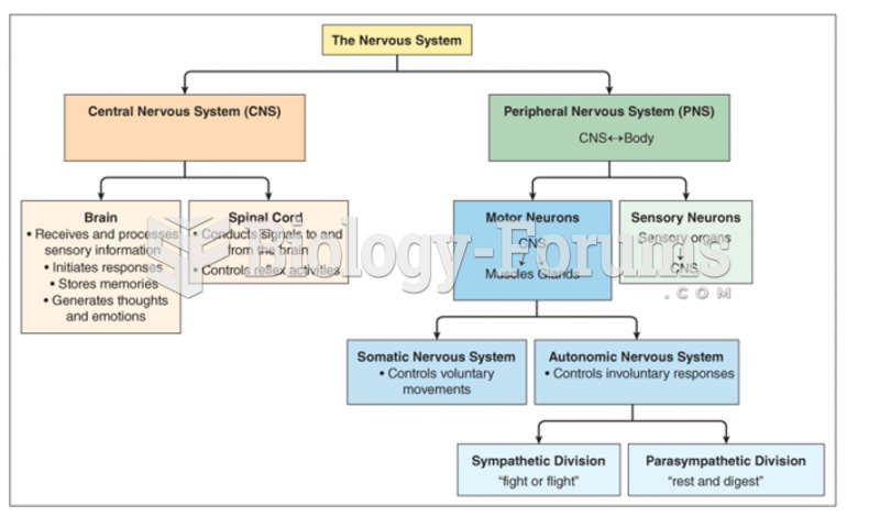 Function divisions of nervous system