This topic contains a solution. Click here to go to the answer
|
|
|

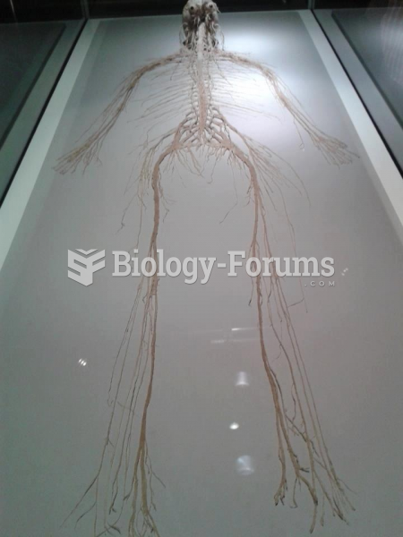 The central and peripheral nervous system
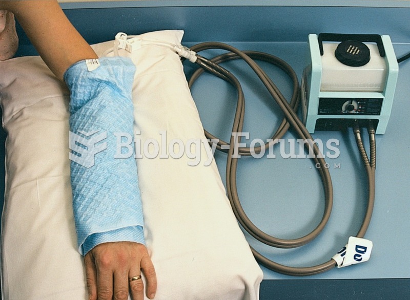 Aquamatic pad and heating unit provide dry heat treatment to a patient’s arm.
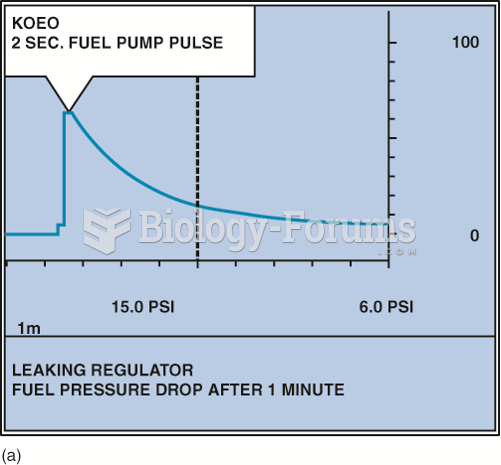 A fuel-pressure graph after key on, engine off (KOEO) on a TBI system.
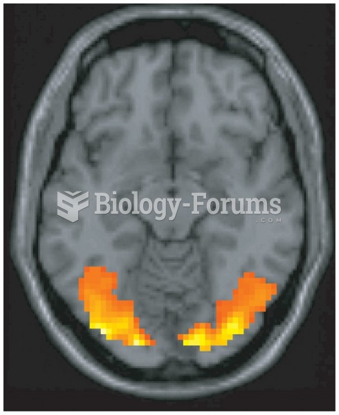 Functional brain imaging is the major method of cognitive neuroscience. This image—taken from the ...
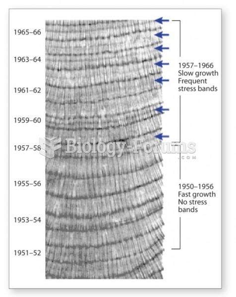 The annual pattern of rings changes with ocean temperature and coral health
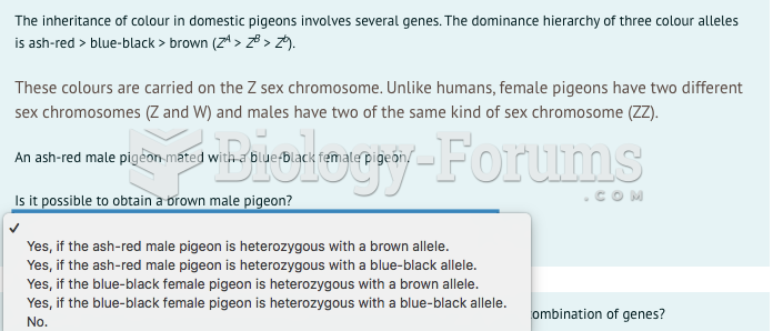 PLEASE I NEED SUPPORT WITH THIS QUESTIONS IS ON THE IMAGE PLEASE ANSWER