This topic contains a solution. Click here to go to the answer
|
|
|

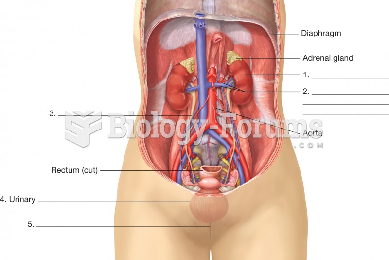 Organs of the urinary system. This illustration is an anterior view of a female with the abdominal w
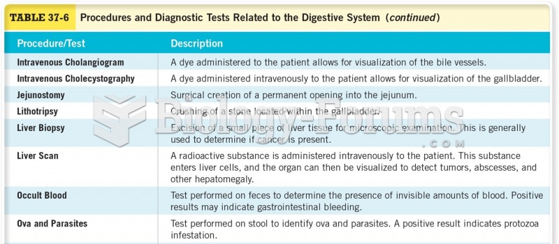 Procedures for Diagnostic Tests Related to the Digestive System
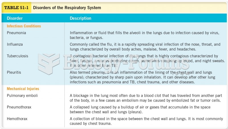 Disorders of the Respiratory System Cont
 The NFPA 704 marking system. This voluntary marking system is displayed at participating facilities ...
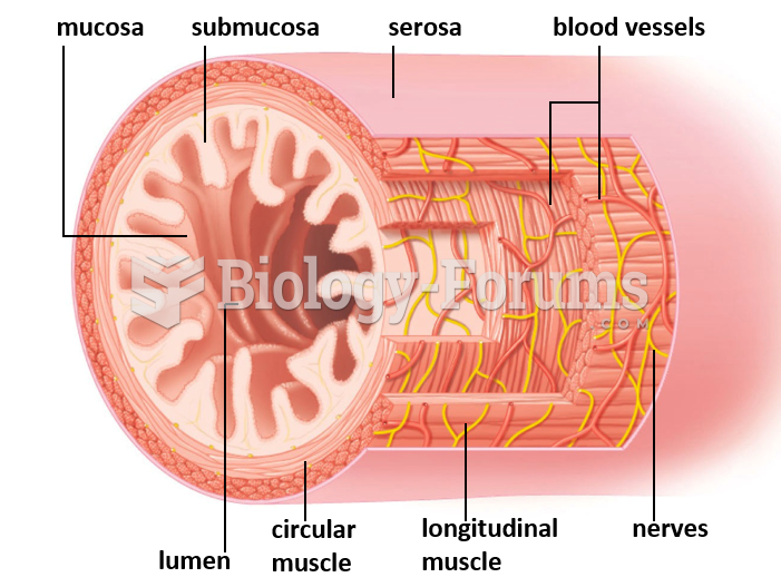 Overview of the Digestive System
 The gas division of Power-U-Up plans to introduce a new gas delivery system based on the ...