|
|
|

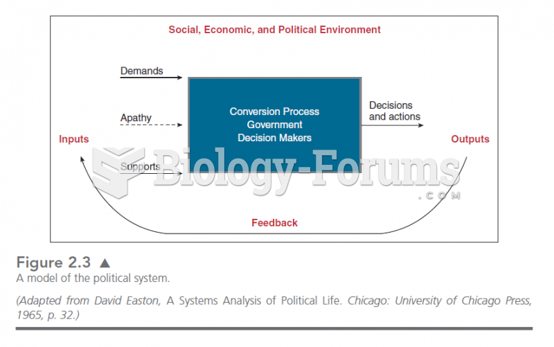 This graphic illustrates the original systems model of politics advanced by David Easton. Politics
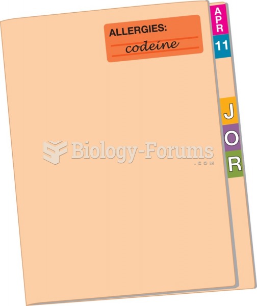 Using alert labels enables the medical staff to quickly identify important information such as ...
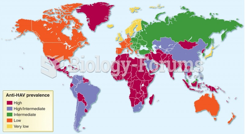 Geographic distribution of hepatitis A prevalence (anti-HAV-antibody), 2005.
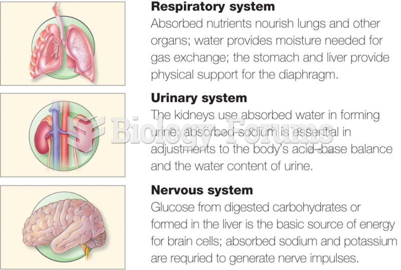 Respiratory system, Urinary and Nervous systems
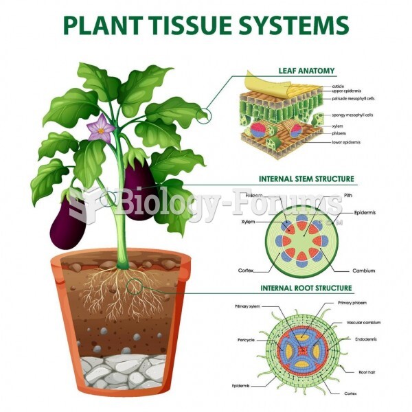 plant tissue systems
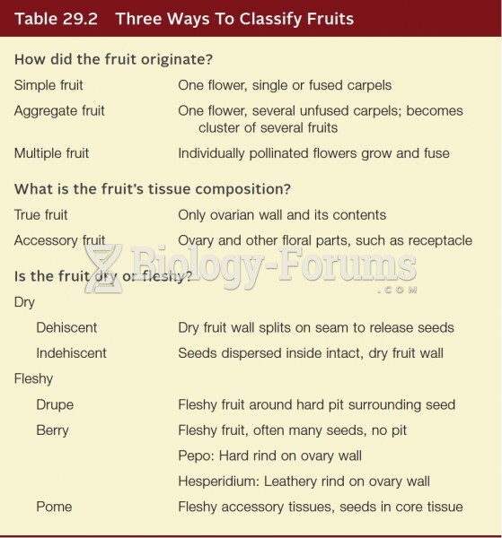 Three ways to classify fruits