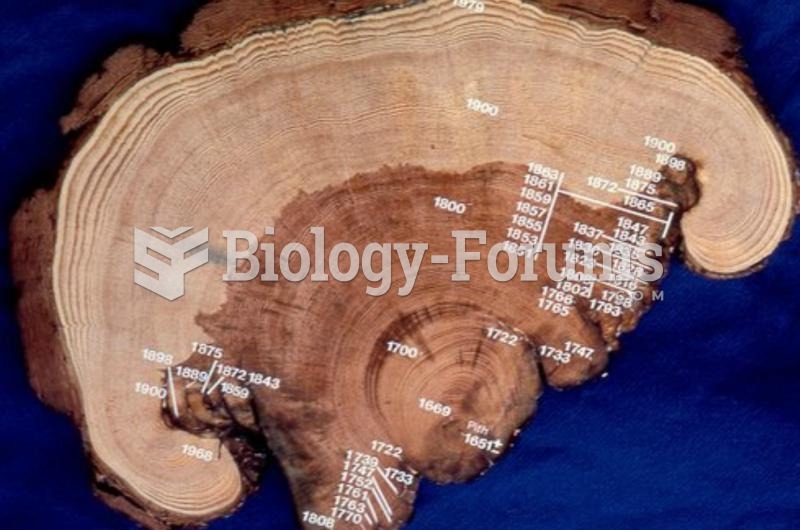
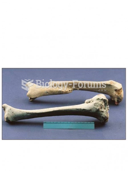
Author Question: When Geographic Information Systems produce maps, spatial data can be produced in two ways: A) ... (Read 16 times)

audragclark

  • Hero Member
  • *****
  • Posts: 579
When Geographic Information Systems produce maps, spatial data can be produced in two ways:
 
  A) Vector Data and Feature Data B) Feature Data and Demographic Data
  C) Raster Data and Feature Data D) Vector Data and Raster Data

Question 2

The first technologies that police officers carried to protect themselves were the nightstick and the handgun.
 
  Indicate whether the statement is true or false


GCabra

  • Sr. Member
  • ****
  • Posts: 331
Answer to Question 1

D

Answer to Question 2

TRUE


Related Topics

Need homework help now?

Ask unlimited questions for free

Ask a Question
 

Did you know?

You should not take more than 1,000 mg of vitamin E per day. Doses above this amount increase the risk of bleeding problems that can lead to a stroke.

Did you know?

Elderly adults are at greatest risk of stroke and myocardial infarction and have the most to gain from prophylaxis. Patients ages 60 to 80 years with blood pressures above 160/90 mm Hg should benefit from antihypertensive treatment.

Did you know?

The use of salicylates dates back 2,500 years to Hippocrates's recommendation of willow bark (from which a salicylate is derived) as an aid to the pains of childbirth. However, overdosage of salicylates can harm body fluids, electrolytes, the CNS, the GI tract, the ears, the lungs, the blood, the liver, and the kidneys and cause coma or death.

Did you know?

Green tea is able to stop the scent of garlic or onion from causing bad breath.

Did you know?

Cancer has been around as long as humankind, but only in the second half of the twentieth century did the number of cancer cases explode.

For a complete list of videos, visit our video library