Answer to Question 1
ANSWER: Information on cloud thickness and height can be deduced from satellite images. Visible images show sunlight reflected from a cloud's upper surface. Because thick clouds have a higher albedo (reflectivity) than thin clouds, they appear brighter on a visible satellite image. Since middle and low clouds have just about the same albedo, which makes it difficult to distinguish among them simply by viewing them in visible light, infrared cloud images are used. Such pictures produce a better image of the actual radiating surface because they do not show the strong visible reflected light. Since warm objects radiate more energy than cold objects, high temperature regions can be artificially made to appear darker on an infrared image. Because the tops of low clouds are warmer than those of high clouds, cloud observations made in the infrared can distinguish between warm low clouds (dark) and cold high clouds (light). Cloud temperatures can then be converted by a computer into a three-dimensional image of the cloud.
Another specialized satellite also provides enhanced detail on clouds and precipitation. Launched in 2006, the satellite CloudSat circles Earth in an orbit about 700 km above the surface. Onboard CloudSat, a very sensitive radar (called Cloud Profiling Radar, or CPR) uses microwave radiation to peer into a cloud and unveil its very fine structures, including the altitude of the cloud's top and base, its thickness, optical properties, the the abundance of liquid and ice particles, along with the intensity of precipitation inside the cloud.
Answer to Question 2
ANSWER: lightning - cumulonimbus
brief heavy rain - cumulonimbus
halo - cirrostratus
hail - cumulonimbus
steady rain - nimbostratus
mackerel sky - cirrocumulus
tornadoes - cumulonimbus
watery sun - altostratus

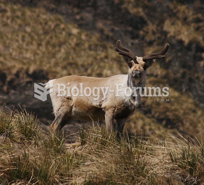 Southernmost reindeer: a South Georgian reindeer with velvet-covered antlers
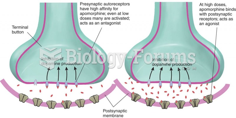 Effects of Low and High Doses of Apomorphine
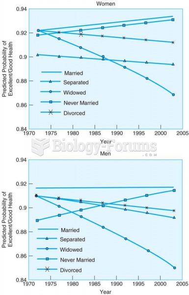 Over the past four decades, the self-reported health of married men and women has remained high, ...
 The high-voltage shut-off switch on a Ford Escape hybrid. The switch is located under the carpet at ...
 High school science classes are required to use deductive logic
 A 60-kg skier starts from rest from the top of a 50-m high slope. If the work done by friction ...