This topic contains a solution. Click here to go to the answer
|
|
|

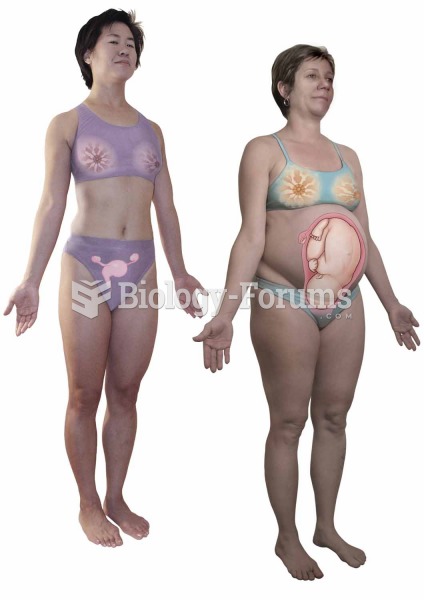 Female genital and reproductive system.
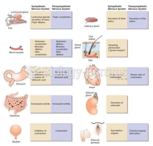
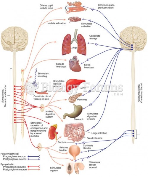 The Autonomic Nervous System
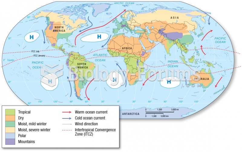 The Koeppen System
 Endocrine System
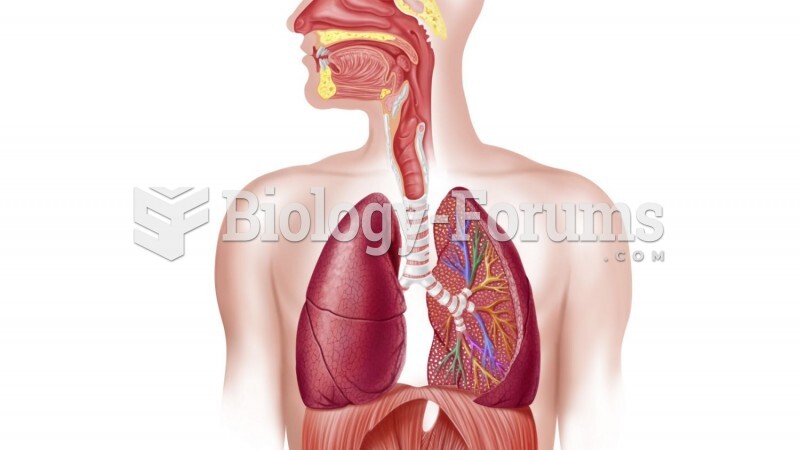 Respiratory system