Answer to Question 1
Answer:
This satellite image shows a section of the Basin and Range Province. The fault-block mountains are being weathered in this arid environment, producing landforms like the alluvial fans and bajada indicated on the photo, as well as salt flats and playa lakes. Alluvial fans form as detrital sediment is (infrequently but effectively) carried down drainages coming off the surrounding mountain ranges. It piles up when it crosses the basin-bounding fault and hits the valley floor. If the fan growth is rapid or extended over a long period of time, adjacent fans may merge with their neighbors, producing a continuous apron of sediment all along the mountain range's flanks. This is a bajada. Meanwhile, those same infrequent rains also pick up a dissolved load, and when the water evaporates from temporary playa lakes and the basin-floor drainages that feed them, salts are deposited, making salt flats and playas. To produce this scene, first normal faulting would have to occur due to east-west extension, and then the landscape would have to experience a redistribution of rock mass due to weathering and erosion in the ranges, and deposition in the basins, as described above.
Answer to Question 2
Various combinations are possible. One source of migrants is Syria with its ongoing civil war that has become a regional crisis. Escaping war and economic and societal collapse is the push factor. Somalia is a failed state, so trying to find another location to reestablish a sense of a normal life.

 The proportion of obese and extremely obese adults in the United States has increased over the past
 The percentage of women over 40 in the United States who are childless has almost doubled in the ...
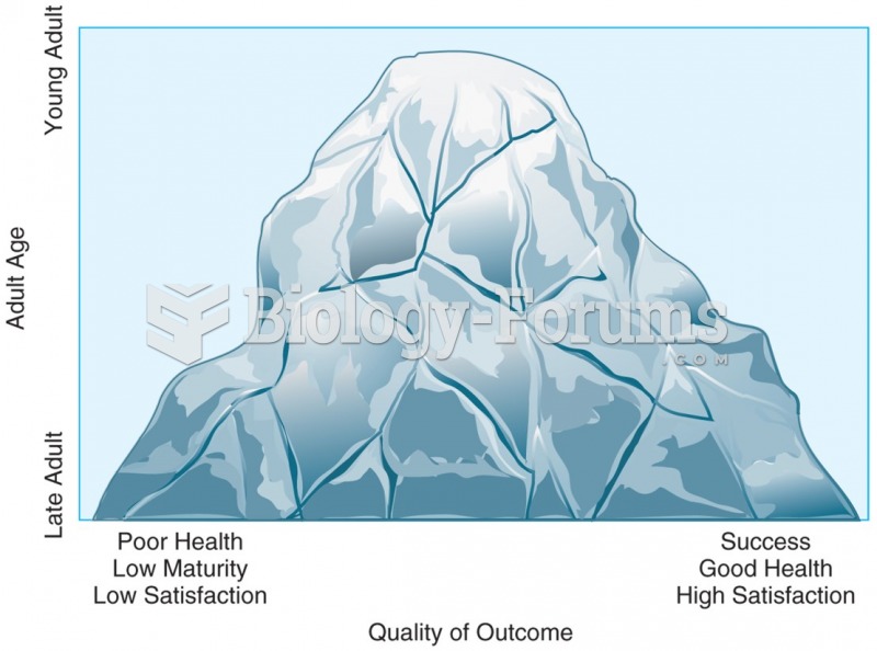 One way to illustrate the journey of adulthood is with the image of a mountain landscape. One begins ...
 Cohabitation in the United States
 Per capita consumption of power is high in the developed world and highest in the United States
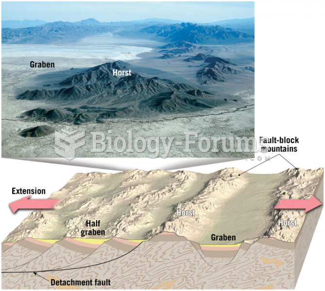 Normal Faulting – Basin and Range Province