Answer to Question 1
Answer:
This satellite image shows a section of the Basin and Range Province. The fault-block mountains are being weathered in this arid environment, producing landforms like the alluvial fans and bajada indicated on the photo, as well as salt flats and playa lakes. Alluvial fans form as detrital sediment is (infrequently but effectively) carried down drainages coming off the surrounding mountain ranges. It piles up when it crosses the basin-bounding fault and hits the valley floor. If the fan growth is rapid or extended over a long period of time, adjacent fans may merge with their neighbors, producing a continuous apron of sediment all along the mountain range's flanks. This is a bajada. Meanwhile, those same infrequent rains also pick up a dissolved load, and when the water evaporates from temporary playa lakes and the basin-floor drainages that feed them, salts are deposited, making salt flats and playas. To produce this scene, first normal faulting would have to occur due to east-west extension, and then the landscape would have to experience a redistribution of rock mass due to weathering and erosion in the ranges, and deposition in the basins, as described above.
Answer to Question 2
Various combinations are possible. One source of migrants is Syria with its ongoing civil war that has become a regional crisis. Escaping war and economic and societal collapse is the push factor. Somalia is a failed state, so trying to find another location to reestablish a sense of a normal life.

 California Red-Sided Garter Snake
 Harvey Milk was the first openly gay candidate to be elected to office in California.
 Is the self the same as the brain? Materialists contend that in the final analysis, mental states ...
 Tom Wills-Wright, Burj Al-Arab, Dubai, United Arab Emirates.
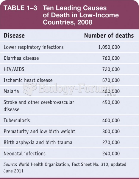 Ten Leading Causes of Death in Low-Income Countries, 2008
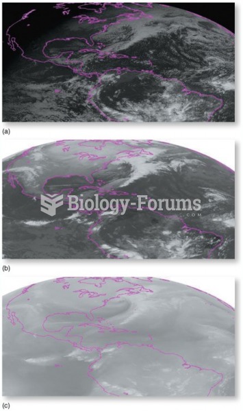 Satellite Images