|
|
|

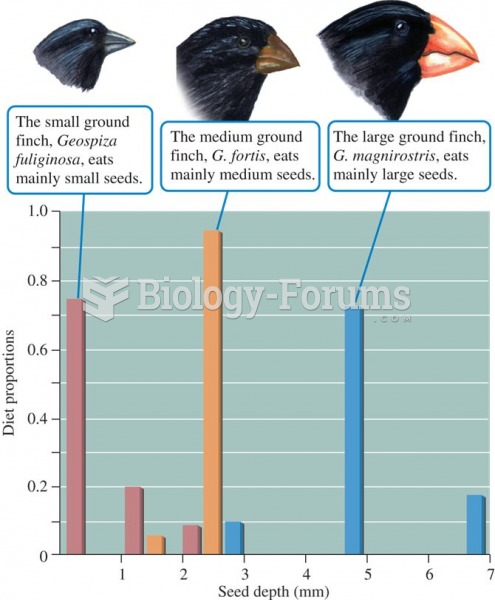 Relationship between body size and seed size in Galapagos finch species
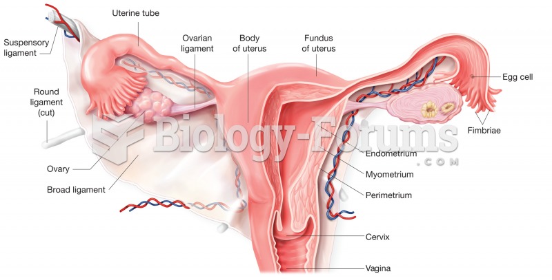 The uterus. Cutaway view shows regions of the uterus and cervix and its relationship to the uterine
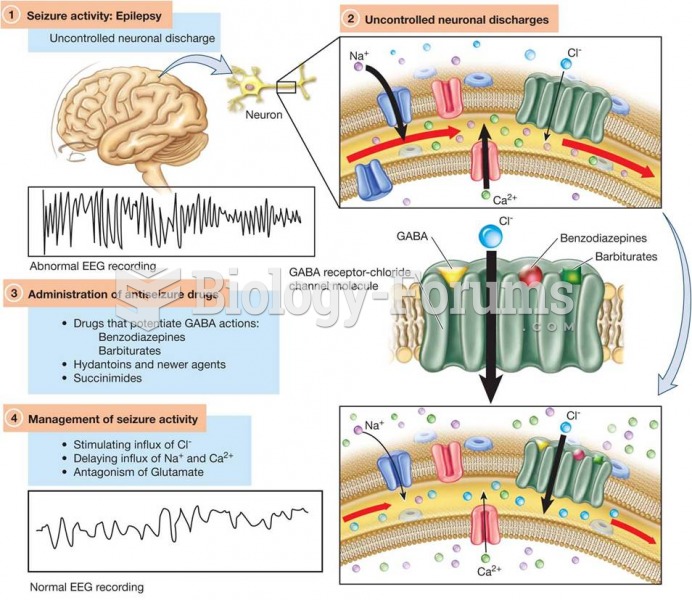 Model of the GABA Receptor–Chloride Channel Molecules in Relationship to Antiseizure Pharmacotherapy
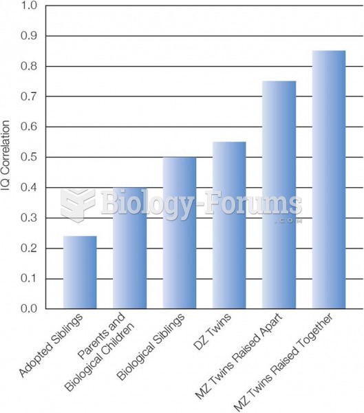 IQ and Genetics The closer the genetic relationship, the higher the correlation in IQ. Based on: Br
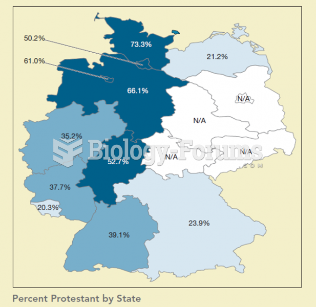 This map shows the percentage of Protestants by state in Germany. When compared to the previous map
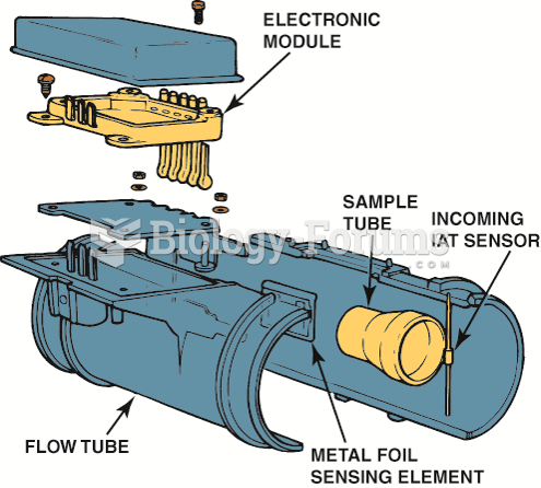 This five-wire mass air flow sensor consists of a metal foil sensing unit, an intake air temperature ...