|
|
|

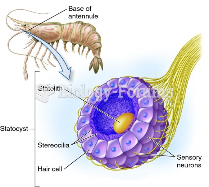 Sensing of balance in aquatic invertebrates.
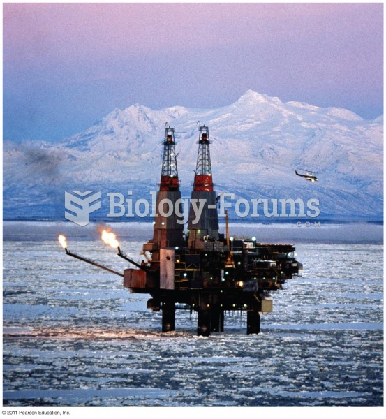 Much Exploration for Oil and Gas Takes Place in Remote Parts of the World
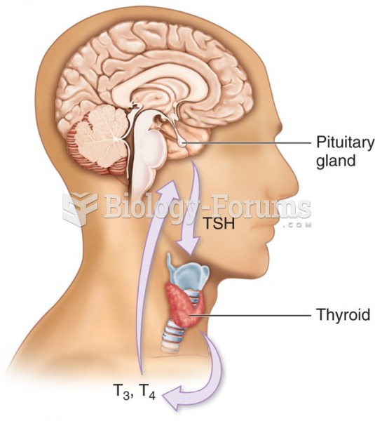 Thyroid hormone production—Relationship between pituitary and thyroid glands. Thyroid hormone ...
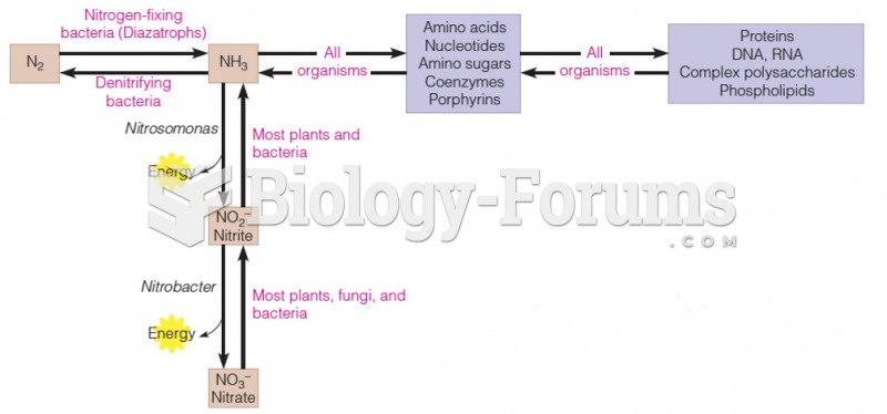 Relationship between inorganic and organic nitrogen metabolism
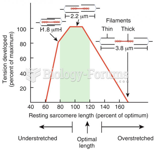 Length-Tension Relationship
 The relationship between acid–base imbalances and potassium imbalances