|
|
|

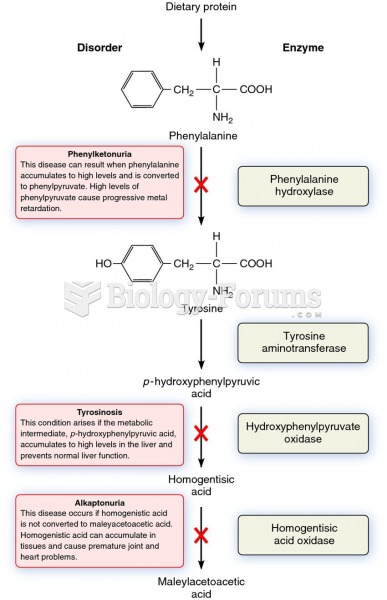 The metabolic pathway that breaks down phenylalanine and its relationship to certain genetic disease
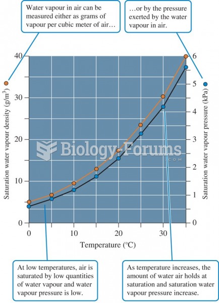 The relationship between air temperature and two measures of water vapour saturation of air.
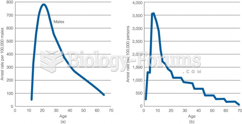 Age-Crime Relationship in (a) 1842 and (b) 1992
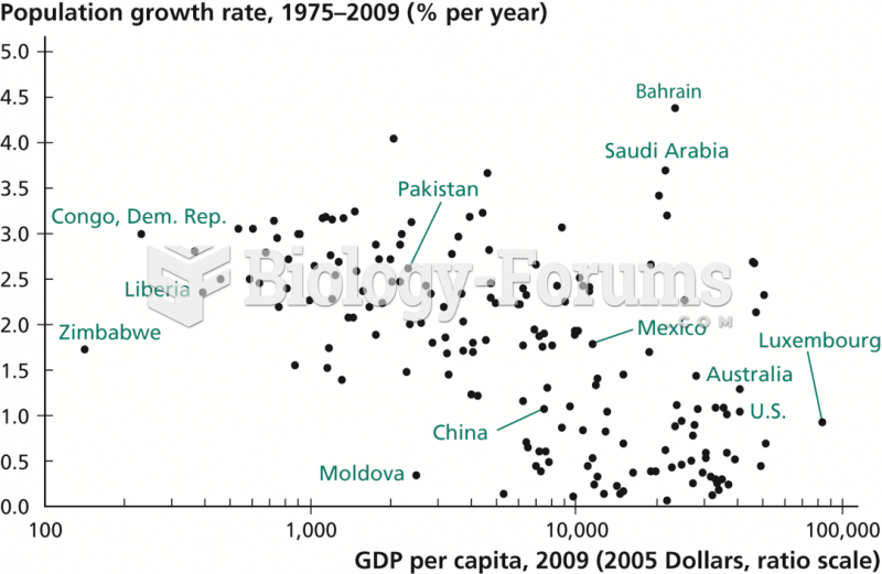 Relationship between Income per Capita and Population Growth
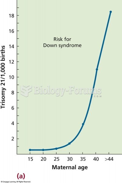 The relationship between maternal age and the frequency of trisomy 21 (Down syndrome). The risk incr
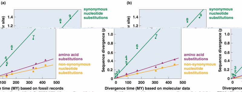 Relationship between the number of amino acid substitutions