|
|
|

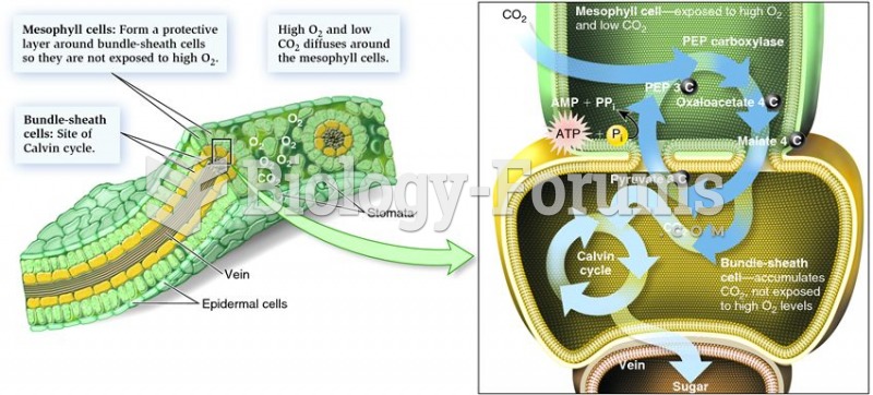 Leaf structure and its relationship to the C4 cycle
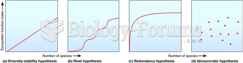 Four main models that describe the relationship between ecosystem function and biodiversity.
 Most elderly enjoy maintaining relationship with their grandkids
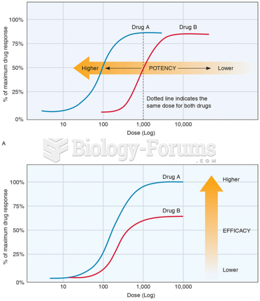 The Dose-Effect Relationship, Showing (A) Drug Potency and (B) Drug Efficacy (Or Effectiveness)
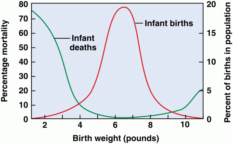 Relationship between birth weight and mortality in humans
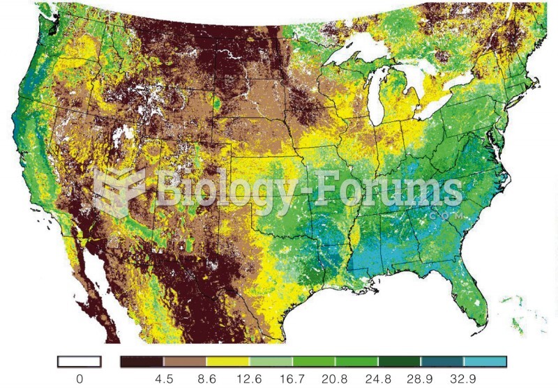 Remote satellite monitoring of gross primary productivity across the United States. The differences