This topic contains a solution. Click here to go to the answer
|
|
|

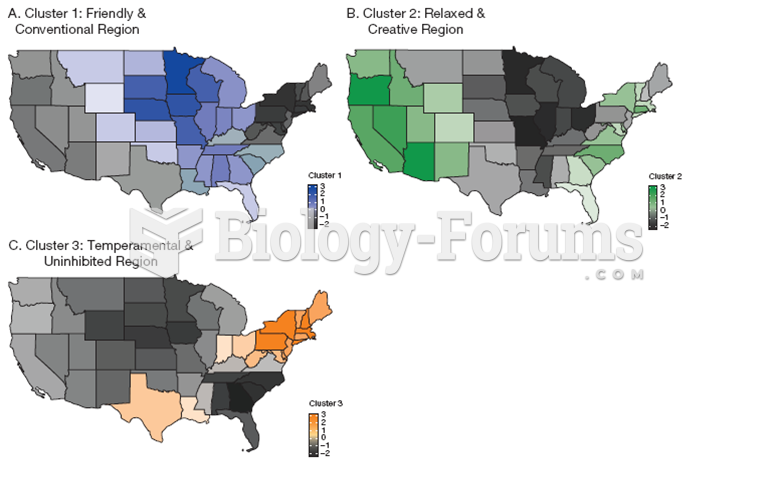 Personality differences in the United States
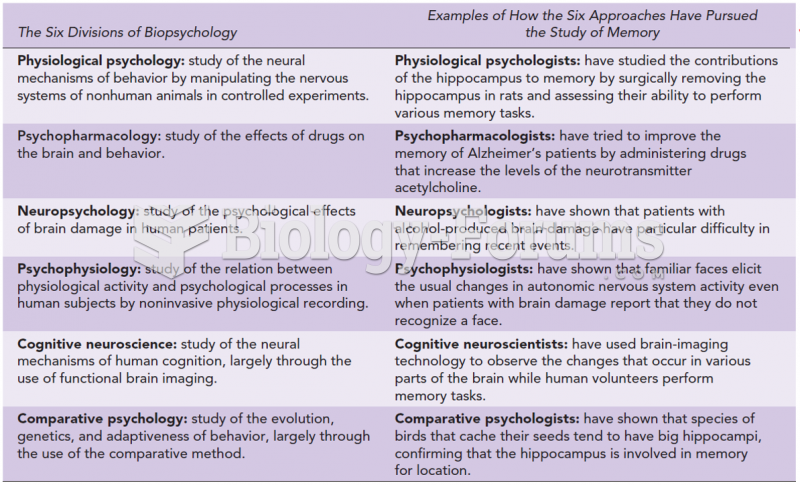 The Six Major Divisions of Biopsychology, with Examples of How They Have Approached the Study of ...
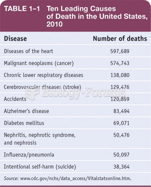 Ten Leading Causes of Death in the United States, 2010.
 Regional Landforms
 Regional and Global Connections
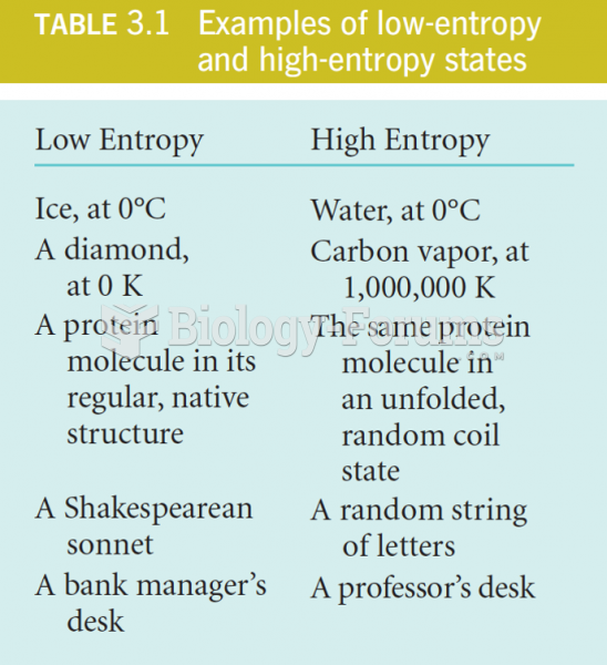 Examples of low and high Entropy states