This topic contains a solution. Click here to go to the answer
|
|
|

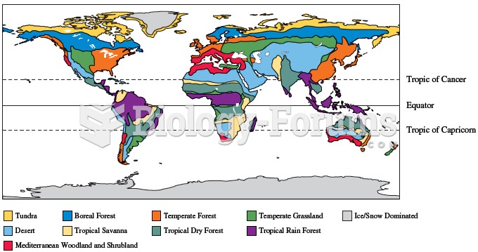 Variation in climatic conditions result in geographic variation in the distribution of biome types a
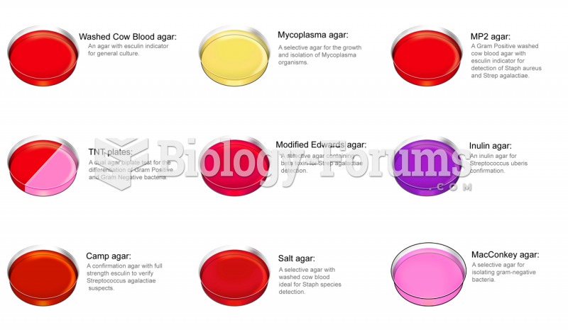 Types of selective media
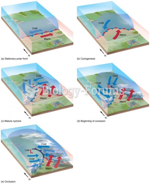 The Life Cycle of a Midlatitude Cyclone: Cyclogenesis
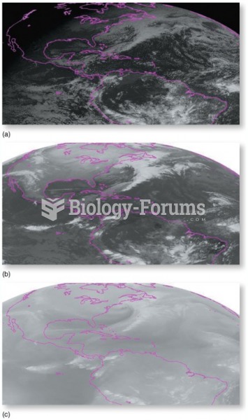 Satellite Images
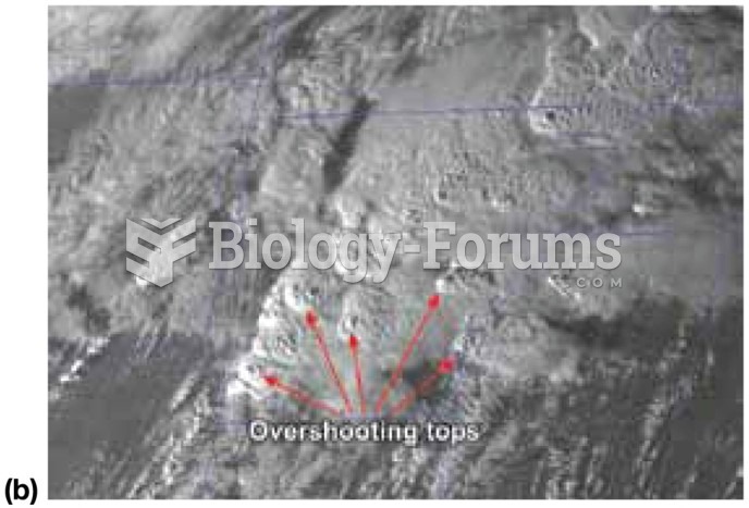 Satellites in Weather Forecasting
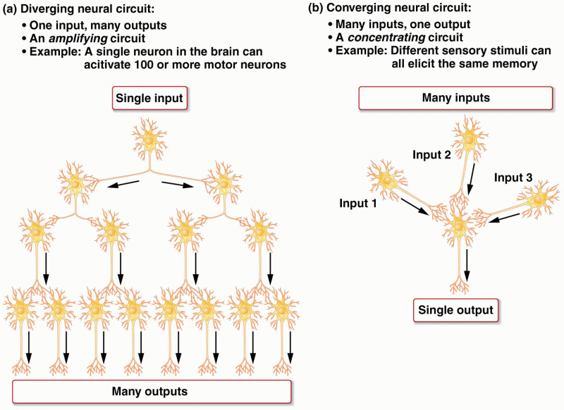 Two major types of nerve circuits in the brain