This topic contains a solution. Click here to go to the answer
|
|
|

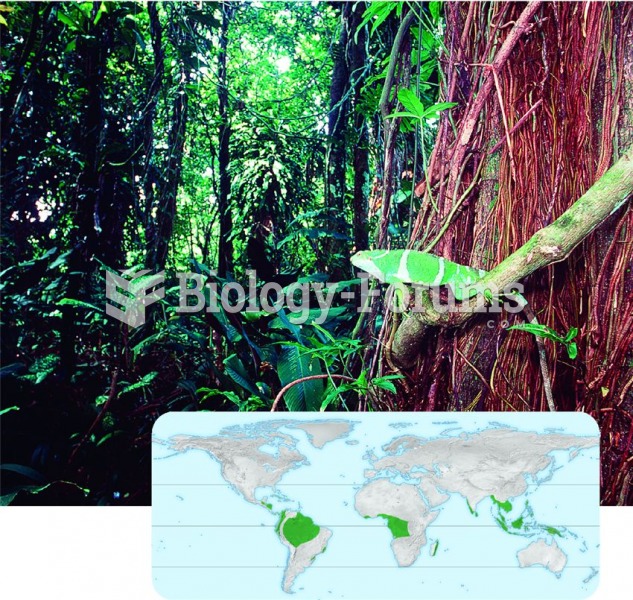 Tropical rain forest in Fiji
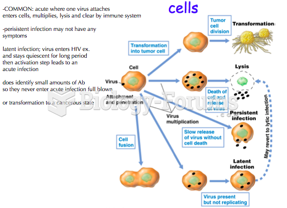 Types of infections and their Effects on host cells
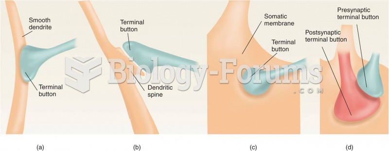 Types of Synapses
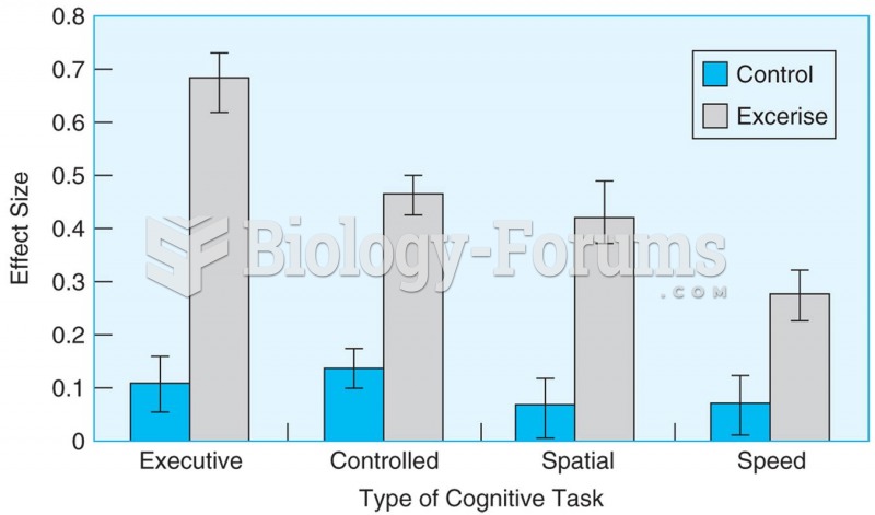 Meta-analysis of 18 studies shows that aerobic exercise causes better performance in older adults on
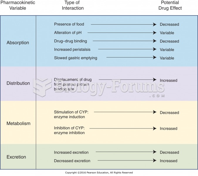 Types of pharmacokinetic drug–drug interactions.
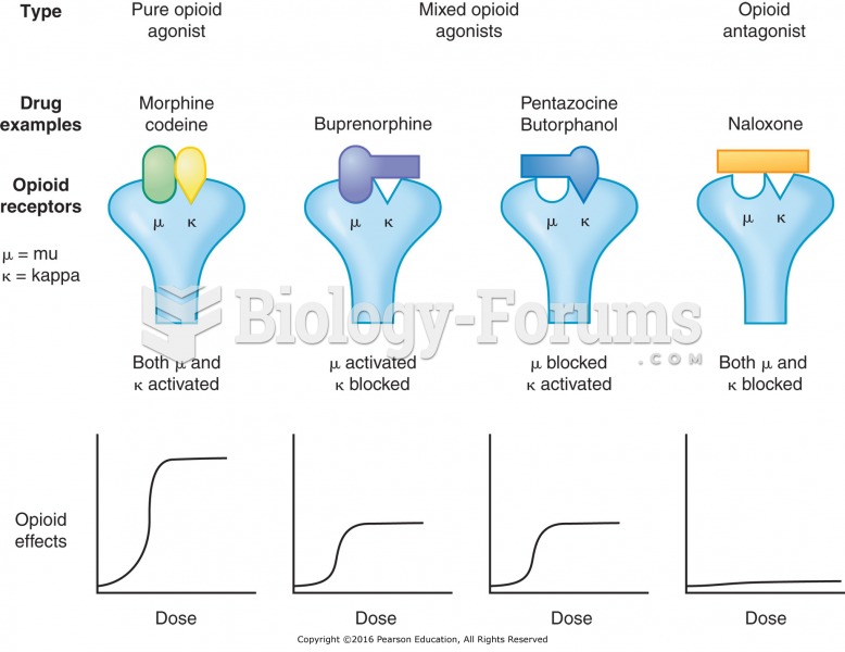 Types of opioid receptors.