This topic contains a solution. Click here to go to the answer
|
|
|

 2008 launch of the SM-3 missile used to destroy American spy satellite USA-193
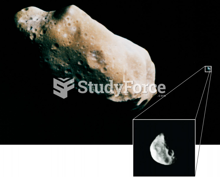 Ida and Its Satellite
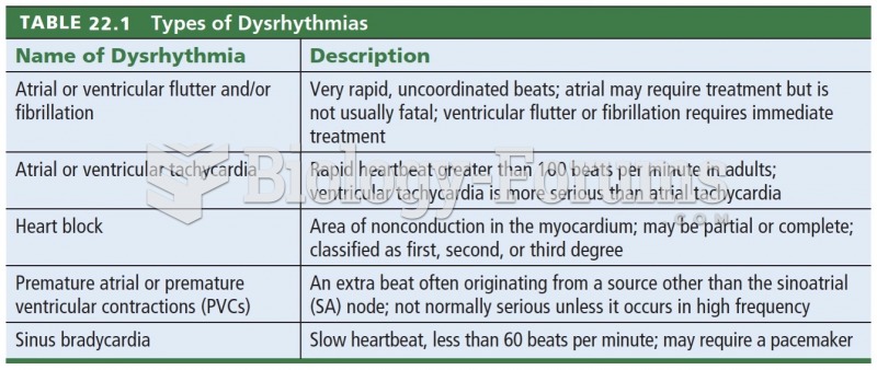 Types of Dysrhythmias
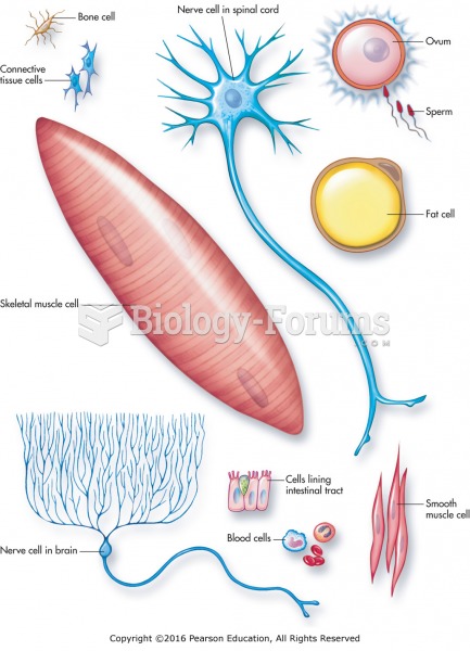 Various types of cells within the human body.
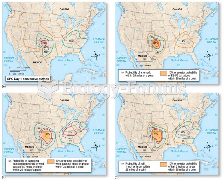 Tornado Forecasting: Convective Outlooks
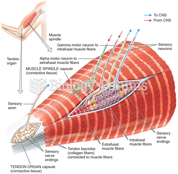 Types of proprioceptors: Muscle Spindles and Tendon Organs