This topic contains a solution. Click here to go to the answer
|
|
|

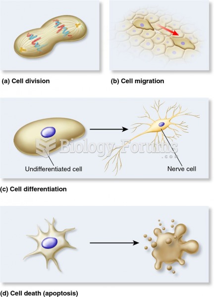 Four types of cellular responses to positional information in animals.
 Cloud Types: Vertical Development
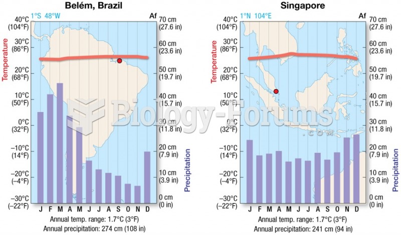 Tropical Wet (Af)
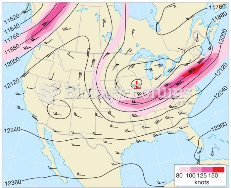 Upper Airflow and Weather Forecasting
 Personality Types in Harry Potter
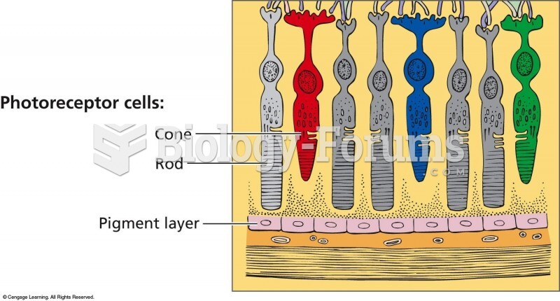 In the retina, there are two types of light receptor cells: Rods are sensitive to differences in lig